
David and I feel very blessed to have met some wonderful people and to have made good friends in our RVing travels. We met Marsha and Glenn our first year “on the road” when we attended the Albuquerque Balloon Fiesta. They were very kind to us and showed us some interesting places nearby. Over our past five years (yes, we have been fulltiming for five years), we have remained friends and we have met up with them numerous times. We caught up with them recently in Farmington, NM. Since they live in the area, they ferried us to see some amazing Navajo cultural sites that few tourists visit. Even many locals are not aware of their existence.
The Navajo people arrived in this area about 1100 A.D. and remained there until the 1700s. Prior to their arrival, these mesas and canyons were occupied by the Ancient Puebloans (500-900 A.D.) Today the Navajo Nation has more than 250,000 members and they refer to their sacred lands as Dinétah.
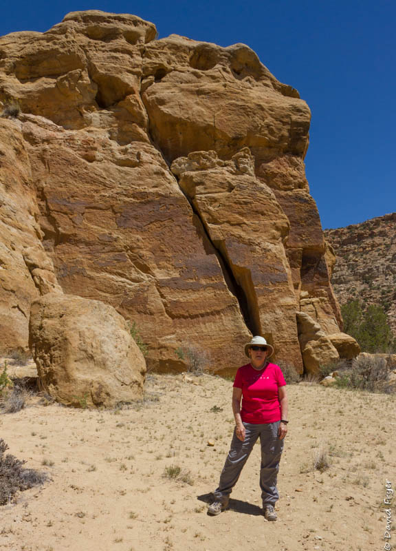
Crow Canyon
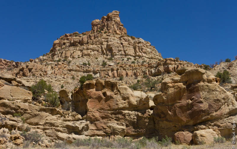
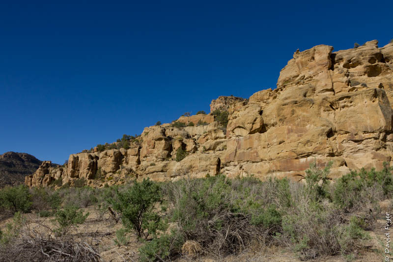
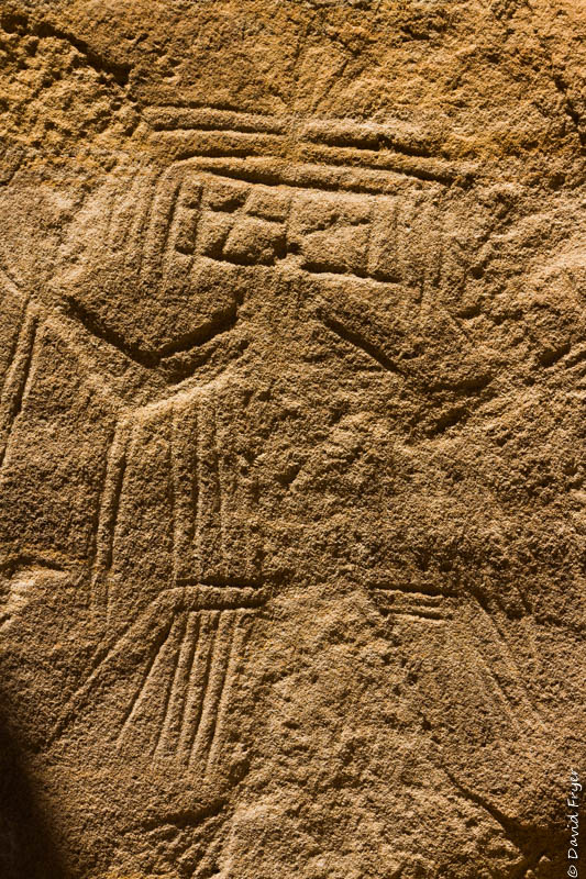
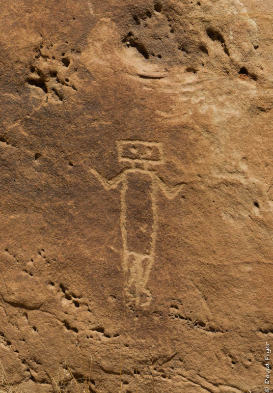
Crow Canyon Archaeological District is part of the Navajo lands. When the Navajo inhabited this region, they built defensive sites called “pueblitos” and also carved petroglyphs into the canyon walls and also drew pictographs on the walls. The petroglyphs were carved using stone, wood, or bone implements.
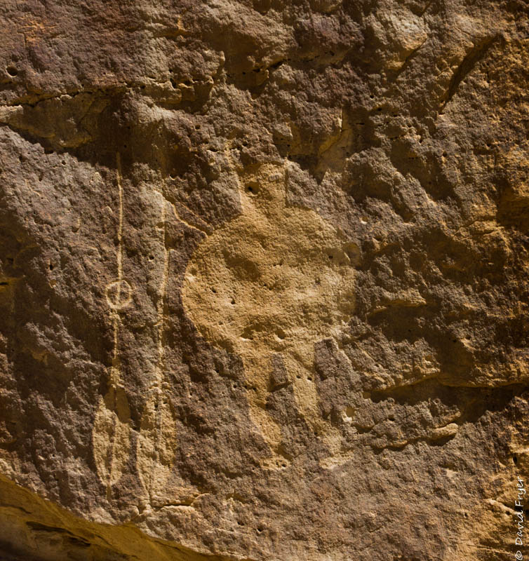
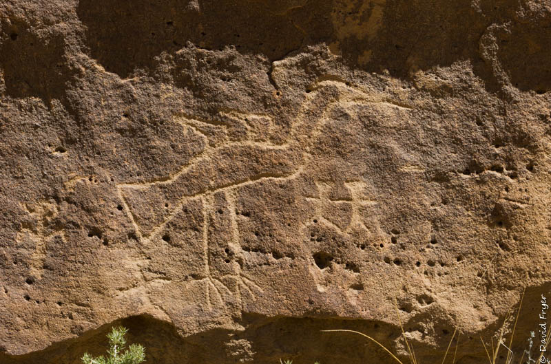
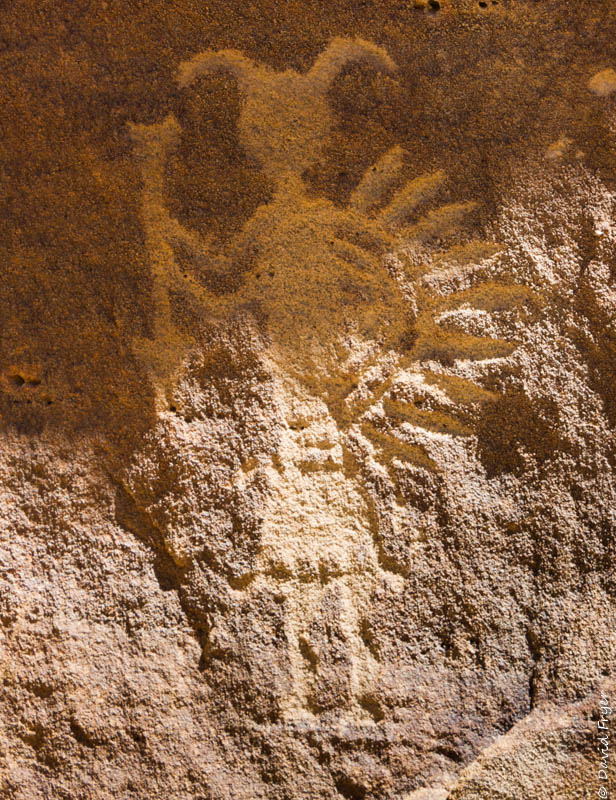
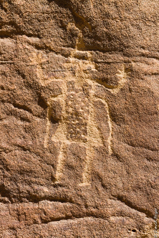
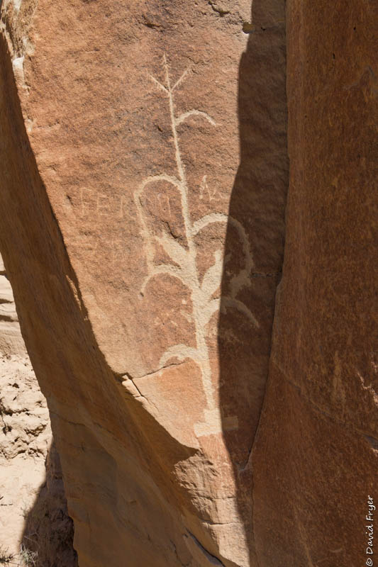
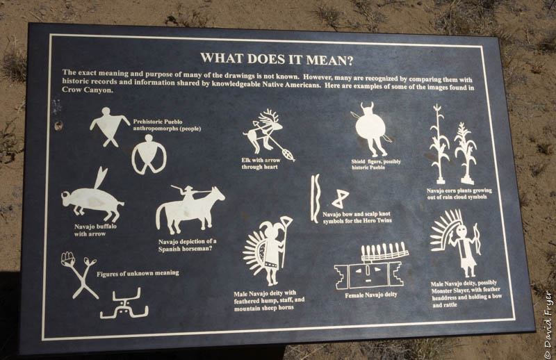
Crow Canyon has the greatest concentration of Navajo rock art in the southwestern United States. Hundreds of images of animals, plants, geometric shapes, and important persons to both the Ancestral Puebloans and Navajo people are organized into groupings called “panels.” These collections of petroglyphs are etched into the lower level of the rock wall so they are easily visible. Archaeologists believe that these panels were used as part of ceremonial activities or educational activities. They might have used them to teach the children or others about their history, culture, and traditions.
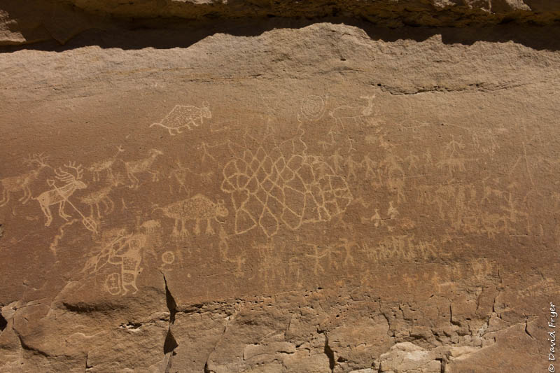
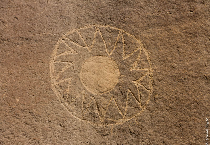
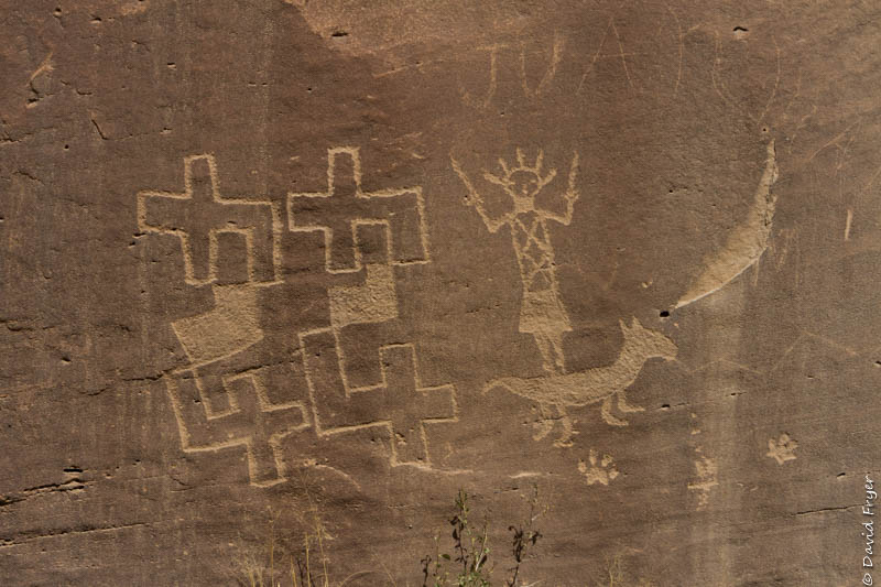
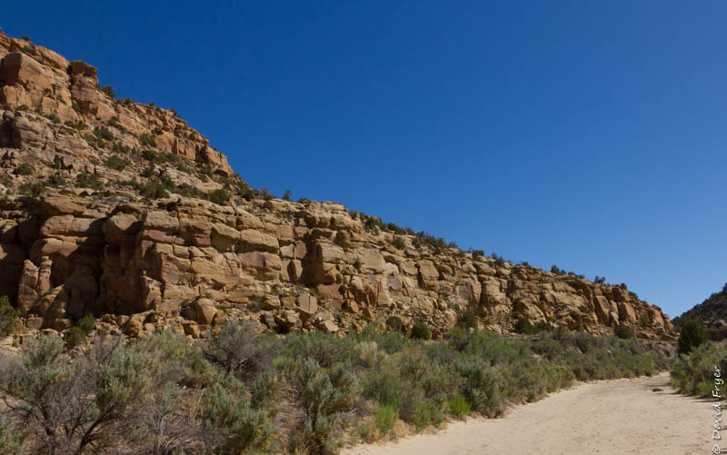
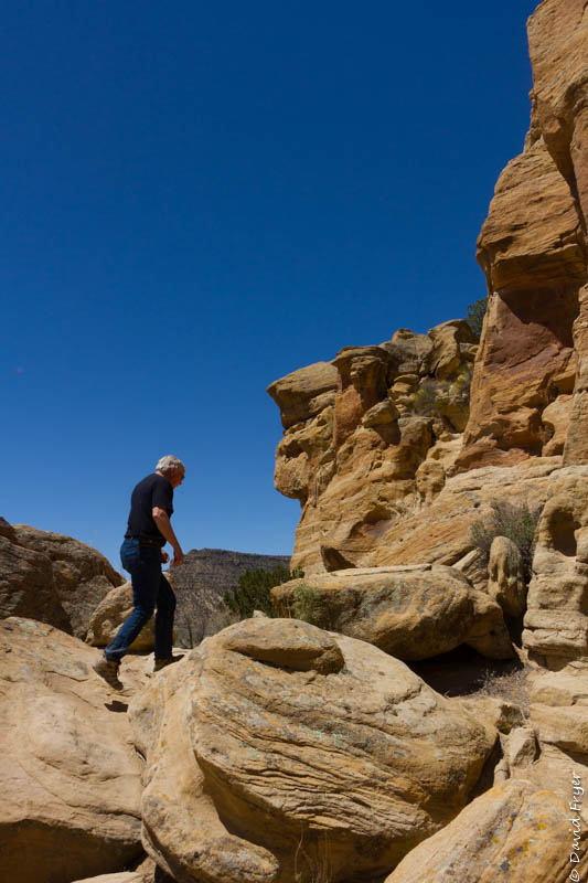
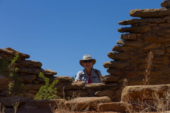
We saw three of the panels that were located on Bureau of Land Management (BLM) land in the canyon. The first was called “44 panel” because there is a petroglyph that appears to be an upside down and right-side up number “44.” To reach 44 panel, we had to hike about a mile from the parking area. The trail went down into a sandy wash that we followed for a while. The trail was not always marked and we were so glad that Glenn and Marsha knew the way. When we arrived, we were thrilled to see some amazing rock art. Many were in excellent condition given their age.
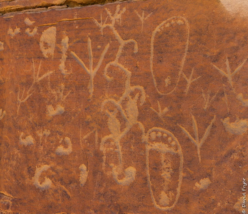
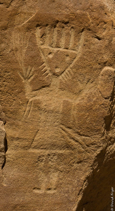
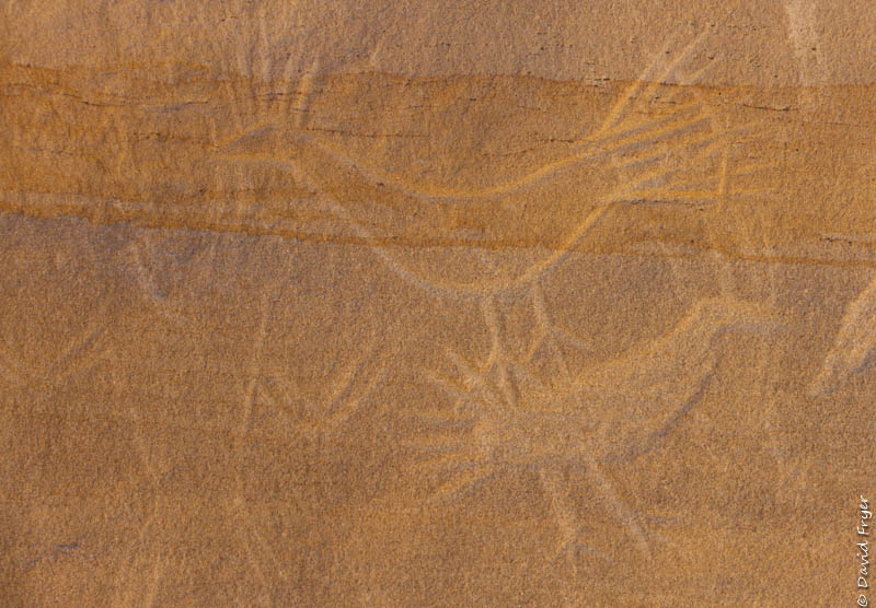
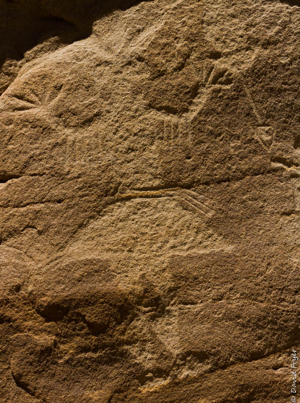
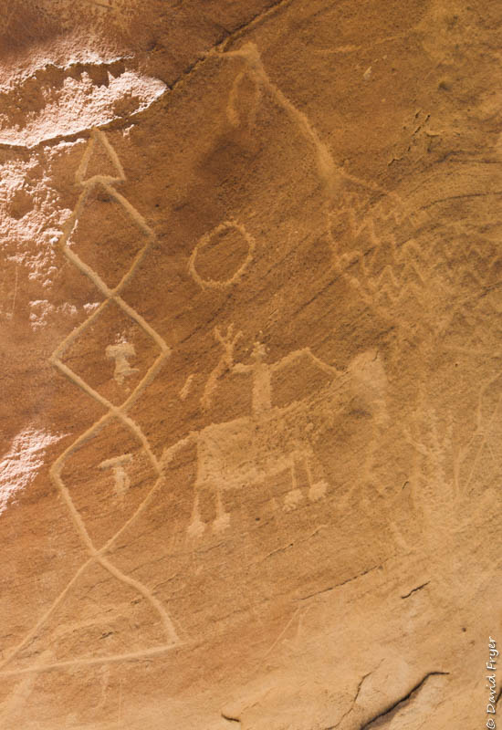
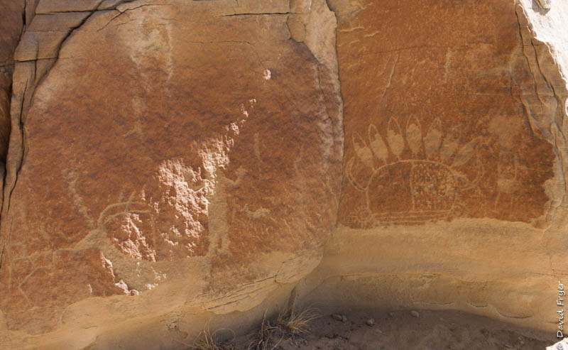
We hiked back and then visited two more panels: the Main Panel and the Big Warrior Panel. Each one was different but equally impressive.
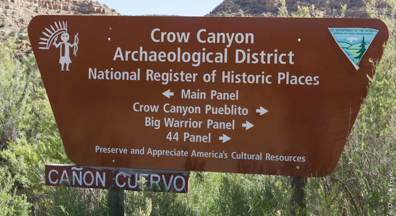
At the final stop, we learned that the Crow Canyon Archaeological District was listed on the National Register of Historic Places in 1974.
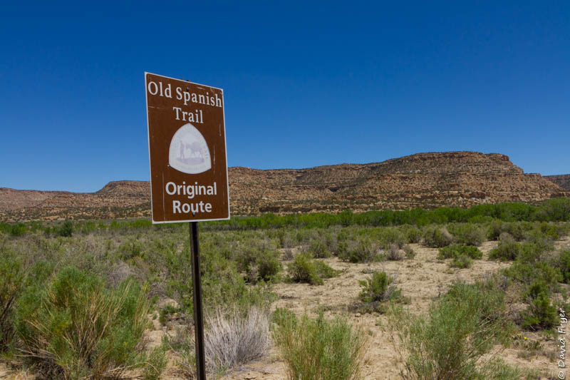
Note that all of these sites are obscure and in a remote area. To gain access to this district, it is recommended that you have a four-wheel drive vehicle during dry season and it is required during wet season. The petroglyphs are 20 miles from any paved road and you have to cross sandy washes to reach the Crow Canyon Archaeological District. There is some signage along the route but we found that, at a critical turn off the rocky gravel road, the sign was missing. Luckily, Glenn and Marsha knew where the turn was – just past a fallen tree! There is no cell service available in the area. Bring lots of water because, even on a cool day, it can be very hot in the canyon.
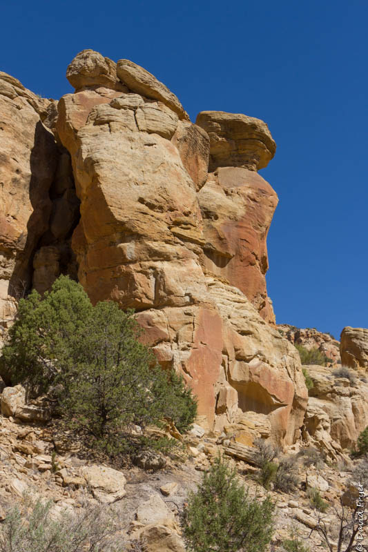
As mentioned above, there were many pueblitos scattered throughout Crow Canyon. They date to 1715-1750 A.D. when there was conflict between the Navajo and the Utes. We did not visit any of these defensive sites because Glenn and Marsha wanted us to see the Francis Canyon Pueblito.
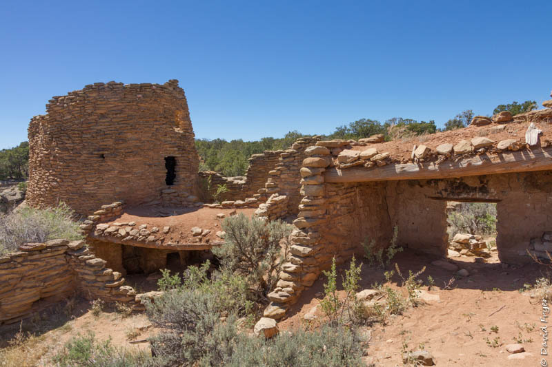
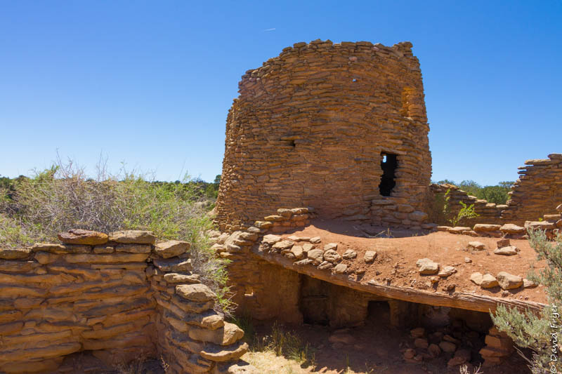
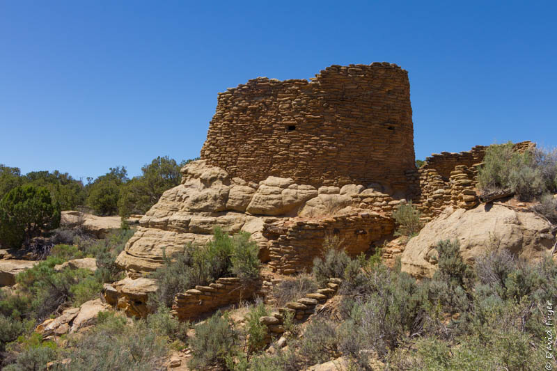
Francis Canyon Pueblito
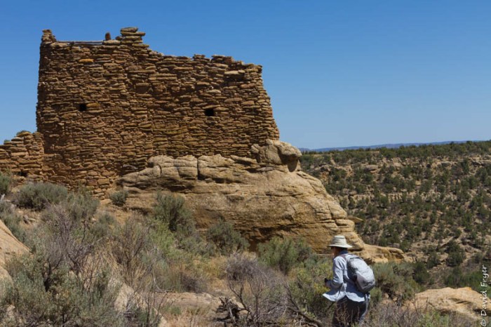
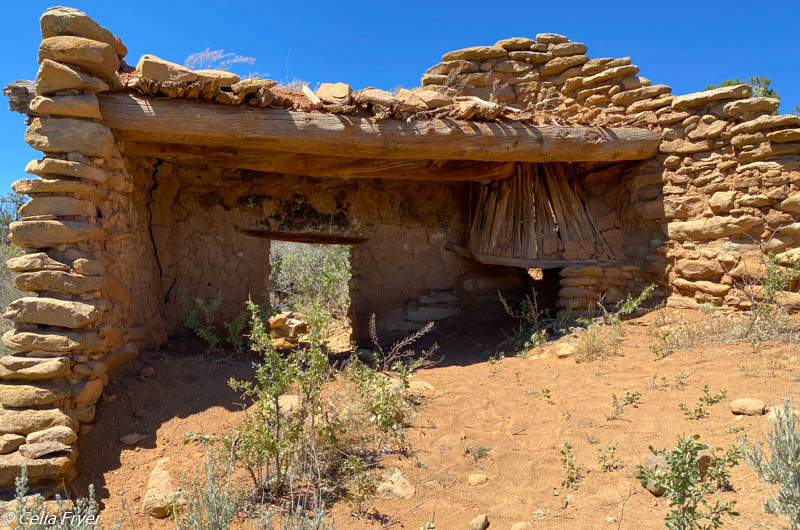
Located on the Francis Mesa, the Francis Canyon Pueblito is one of the three largest and well-preserved defensive complexes in this area. Archaeologists have determined that it was built in three stages. The first was in 1710-1714, the second in 1722, followed by the third in 1735-1736. Earl Morris was the first to excavate this complex site in 1915. This pueblito boasted 23 ground floor rooms, 12 two-story rooms, 3 three-story rooms, and a four-story tower. While not all of the complex is intact, you can see three of the four-stories of the tower and some surrounding structures. The tower sits on top of a massive boulder. These lookout posts and defensive buildings were placed on the edge of the canyon. From this vantage point, the residents could spot enemy advances. It appears that there were conflicts between the Navajo and the Utes and Comanches during this period. The Navajo masons also built “peep holes” near the entrances for additional security. There are other interesting features in these ruins, such as peg holes, storage bins, and hooded fireplaces. It is believed that they abandoned this site in 1745. Archaeologists are not sure why they moved on.
The Bureau of Land Management (BLM) took possession and oversight of these unique ruins in 1975. The Francis Canyon Ruins were listed on the National Registry of Historic Places in 1974 and 1987 to help protect these Navajo cultural sites.
The Francis Canyon Ruins are located about 68 miles east of Farmington, NM. You travel on paved roads until you turn off to head up to the ruins which are at an elevation of 6,805 feet above sea level. Access to the site is via a steep and rocky gravel road. Once again, it is recommended that you have a four-wheel drive vehicle particularly in wet or snowy conditions. Once you reach the parking lot, it is just a short walk to the ruins. Although it was not easy to get there, it was definitely worth the effort to see these Navajo pueblo ruins.
Navajo Lake
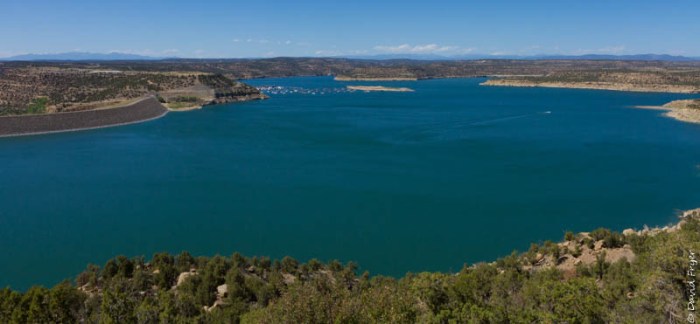
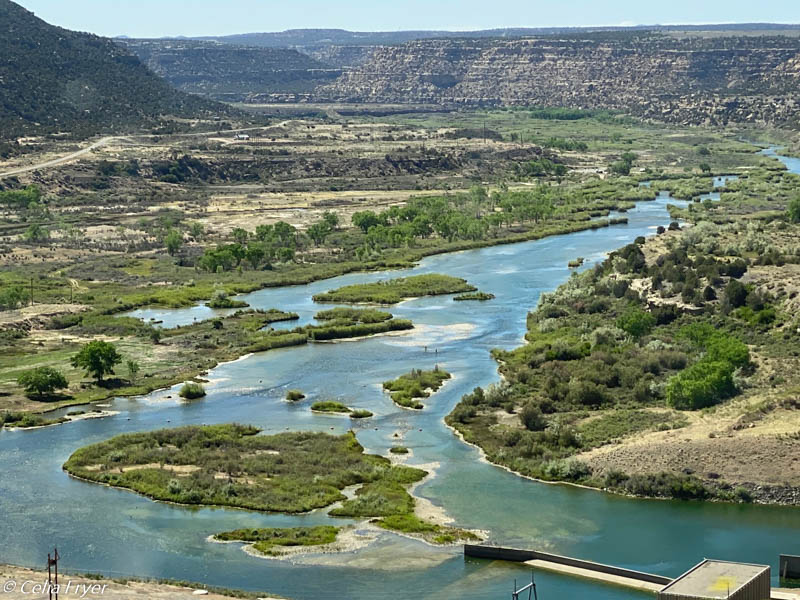
On our way back to Farmington, we drove by Navajo Lake which is the second largest lake in New Mexico. Built in 1962, this man-made lake is 25 miles long. An earth and rock dam that is 3800 feet long and 400 feet high holds back a reservoir that covers 1.7 million acres. We drove over the dam which was very spectacular. Unfortunately, the construction of the lake required the displacement of hundreds of families and the flooding of farm and ranch lands. Some of the Navajo Nation’s sacred sites also lie submerged beneath the lake.
Today, Navajo Lake is a popular place to spend some time fishing, boating, water-skiing, camping or hiking. There are seven campgrounds in the Navajo Lake State Park. The lake provides a lovely respite from the summer heat.
Many, many thanks to Glenn and Marsha for a wonder-filled day. We would not have been able to see any of these Navajo cultural places had it not been for them. We value their friendship and look forward to more adventures together in the future.

Isn’t it great to have friends who are locals to take you to out of the way places like these? I am fascinated with all those petroglyphs.
LikeLike
We were too. We couldn’t believe how many there were. We could not have done it without our friends. It was so remote it was almost like a secret.
LikeLiked by 1 person
Isn’t it great to be traveling again! Great photos of an amazing part of the country!
LikeLiked by 1 person
Thanks! We are enjoying visiting some of the lesser known areas of the country but no less spectacular.
LikeLike
Once again the photographs and narrative are a superb treat! Loved it. Glad I get to see/read these adventures.
LikeLiked by 1 person
Your so kind! Thanks, glad you are enjoying these. Miss seeing you all and hope to before too long.
LikeLike
David & Celia. It was certainly our pleasure to take you to see our secrets and we’re glad that you had a great time. We hope you can come back to join us sometime on the Cumbres & Toltec Scenic Rail Road and to the Bisti Badlands. Both are awesome!
Glenn
LikeLike
Yes, we would LOVE to do that. We wanted to especially go to Bisti but are saving it for another time. Thanks for all your hospitality!
LikeLike