
More and more often these days we have discovered hidden gems in the U.S that are visited infrequently by tourists but that have great significance or beauty. After leaving Cheyenne, WY we decided to take a detour to a spot about which we had heard good things but had never visited: Scotts Bluff National Monument in Gering, Nebraska.
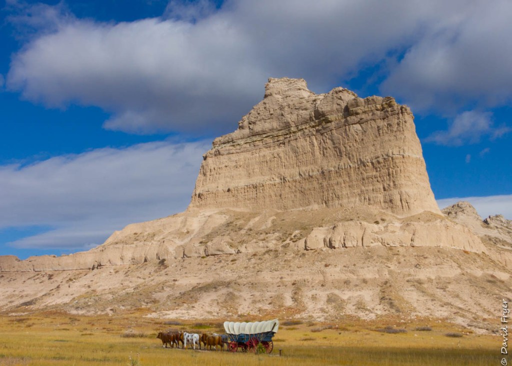
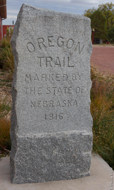
Fighting the perception that Nebraska is nothing but flat fields of grain, Scotts Bluff is a visible outcropping that can be seen for miles along the North Platte River. Because of this, this landmark became an important site along the Oregon Trail in the 19th century. We have been fascinated by the history of the emigrants who traveled this difficult trail for the promise of a better life in the Oregon Territory. Here are some posts from our previous visits to other Oregon Trail landmarks: Oregon City, Three Island Crossing, and Baker City.
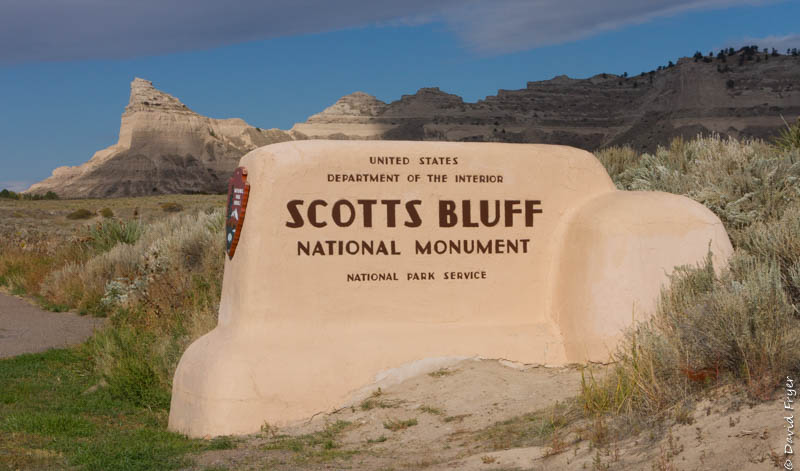
The Scotts Bluff National Monument has a small but well appointed Visitor Center. The building offers information about this area’s importance for travelers and the trading post that was located nearby. When the Oregon Trail emigrants saw Scotts Bluffs, they knew that they were near the Rockies and a step closer to their new life.
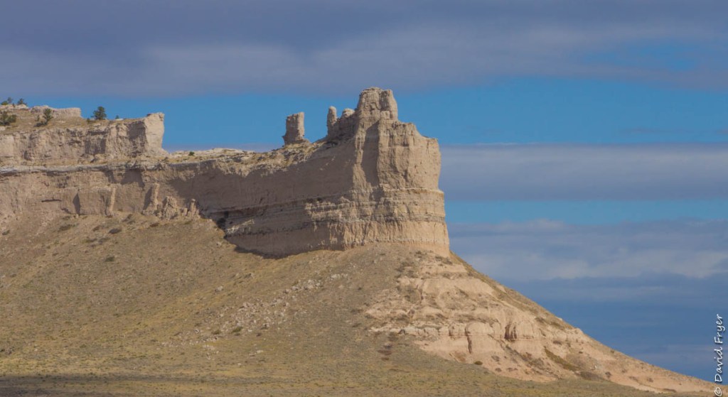
Mitchell Pass, part of the Oregon, California, and Mormon Trails, traverses beside Scotts Bluff and is near the North Platte River. This is also the pathway that the short-lived Pony Express followed. The imposing 800 foot bluffs inspired the name, Me-a-pa-te, or the “hill that is hard to go around.”
Fur trappers first visited this area in 1812, ironically heading east from the Pacific. History shows that seven employees of John Jacob Astor’s Pacific Fur Company camped there on Christmas Day. It was years later in 1828, legend has it, that Hiram Scott of the Rocky Mountain Fur Company died at Me-a-pa-te and after that the bluffs were given a new name.
Emigrants did not tarry long at Scotts Bluff, sometimes called “a Nebraska Gibraltar.” They knew that they were only a third of the way to their destination and winter was coming. After the Union Pacific and Central Pacific railroads were linked in 1869 providing transit to the west, the trail ceased to be the pathway of choice after decades of use.
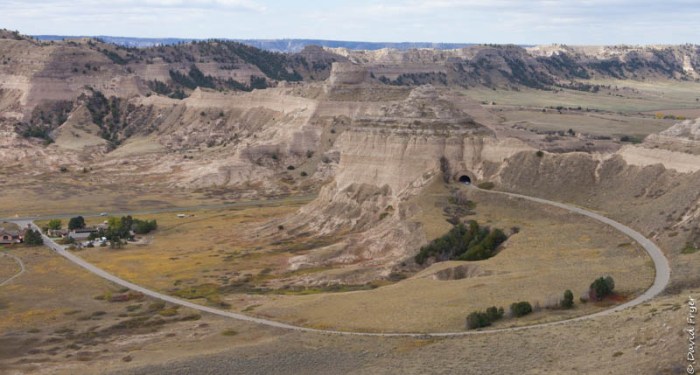
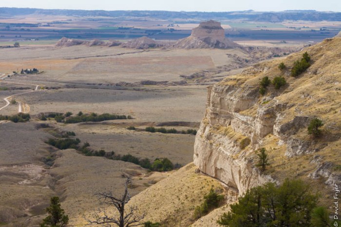
When you visit the monument, there is a road that climbs to the top of the bluffs with trails and viewpoints. This road travels through three tunnels on its way to the summit. From the top there are several nice vistas and short trails. There is also a trail that goes from the Visitor Center to the peak, but it was such a windy day we decided not to try it.
The nearby town of Gering, NE has celebrated the “Oregon Trail Days” every year for the past 102 years. Signs in town remind you that you are driving on the Oregon Trail.
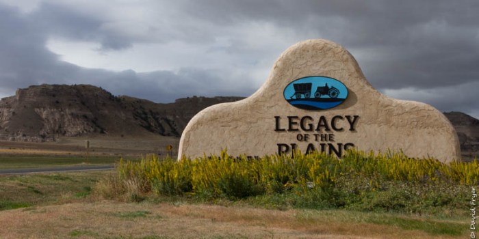
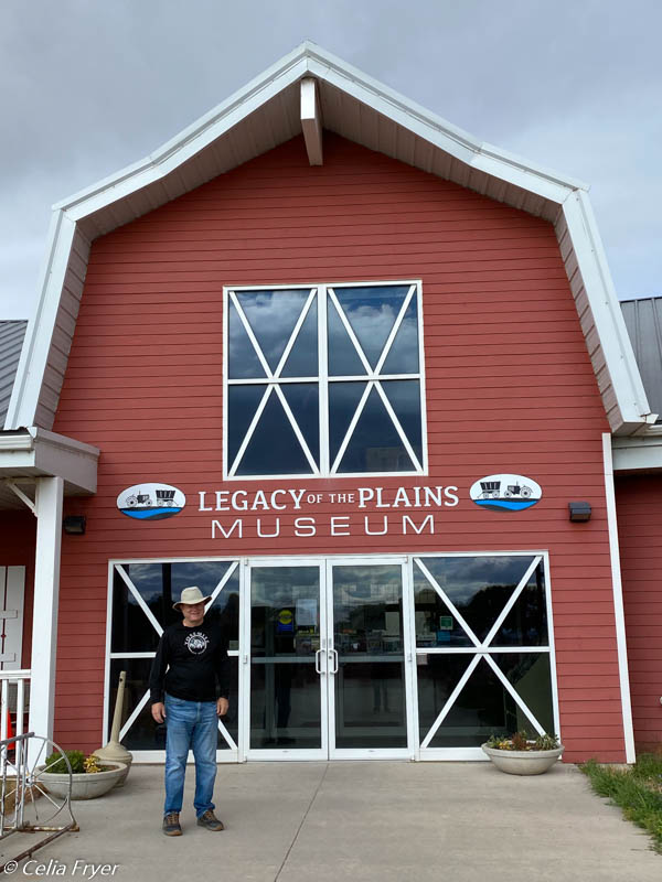
Near the entrance to the monument is a museum called Legacy of the Plains. We probably would not have visited but for the glowing on-line reviews. It is a surprisingly large facility with more farm equipment than we knew even existed.
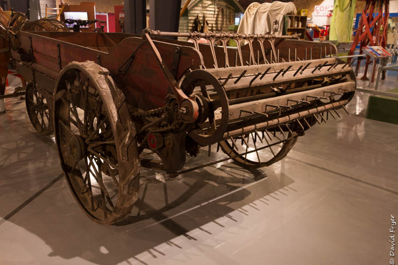
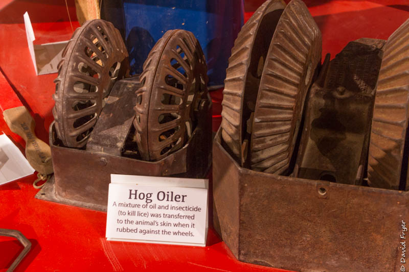
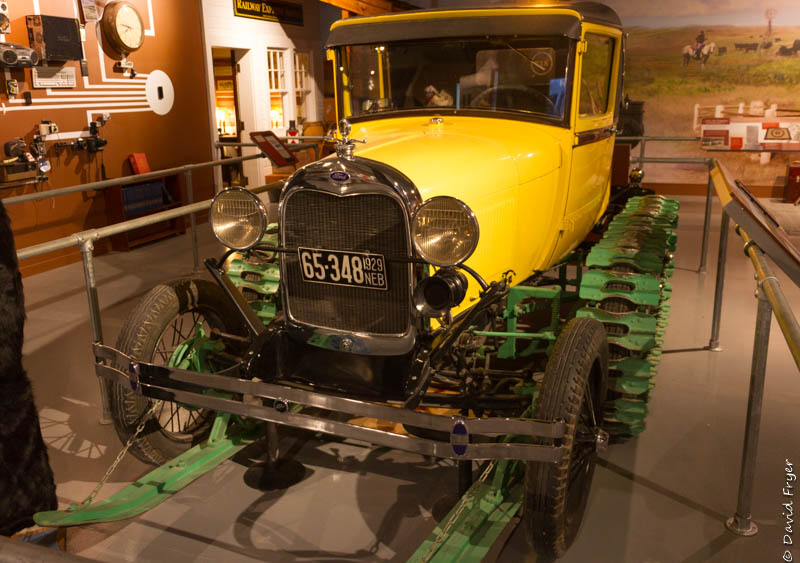
The exhibits seek to tell the story of farming in the challenging environment of the dry Nebraska plains. We also learned that this area is well known for the sugar beet harvest, with the panhandle of Nebraska producing 90% of the state’s harvest. One of the processing plants is in the town of Scottsbluff (yes its one word if the town, two if referring to the county or monument) itself.
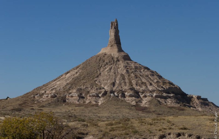
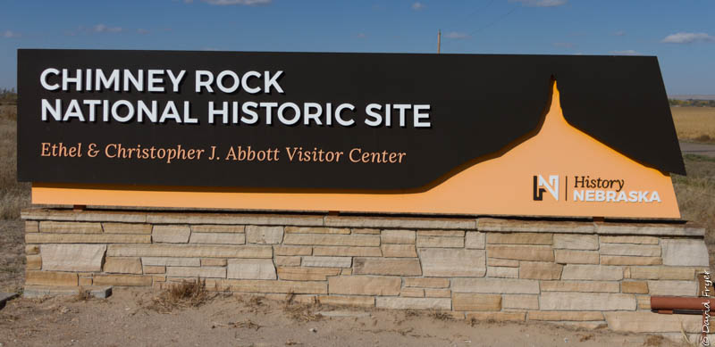
We were also not that far from another landmark called Chimney Rock. We drove there to see it even though the Visitor Center, at this time of year, is only open during the weekends. This iconic landmark, 4,225 feet above sea level, is also revered on the Oregon and Mormon Trails. Emigrants would climb to the top and inscribe their names. Chimney Rock, through the years, has been known by many other names, including TeePee, Wigwam, Nose Mountain, and The Smokestack. This landmark was one of the most cited in the journals of those who traveled westward on the Oregon Trail.
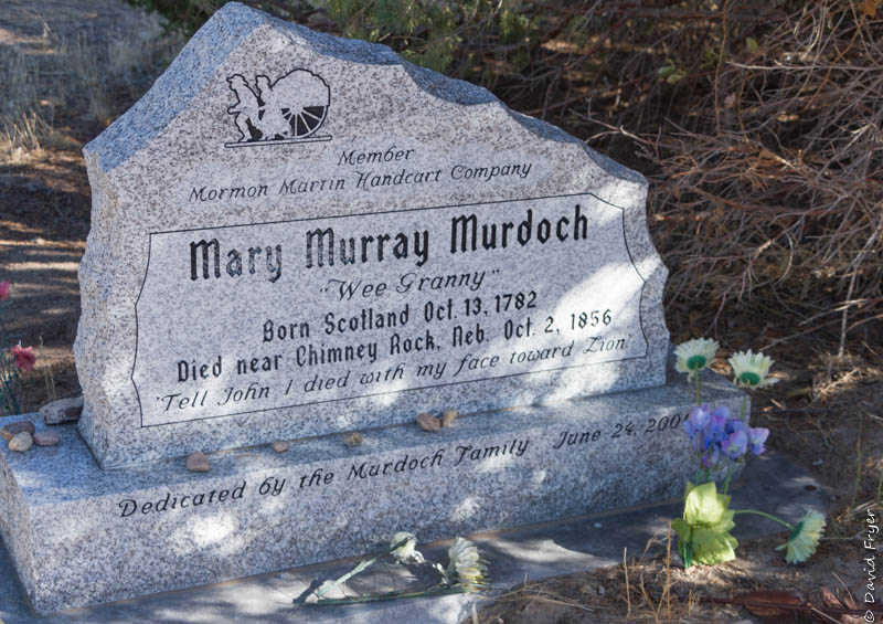
“Tell John I died with my face toward Zion”
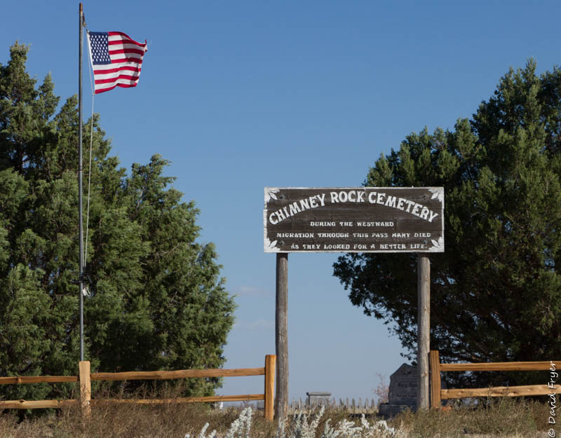
The site even has a cemetery for the unfortunate travelers that did not make it.
If you do some reading about the 2,000 mile Oregon Trail, you will find that an incredible number of travelers died along the way. Cholera was the main culprit. The emigrants’ bodies were often buried in the trail ruts themselves, compacted by the wagon wheels, to keep animals from digging up the remains. The Oregon Trail has been called the longest graveyard in the world with a body buried on average every 80 yards.
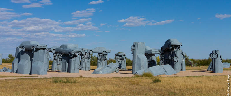
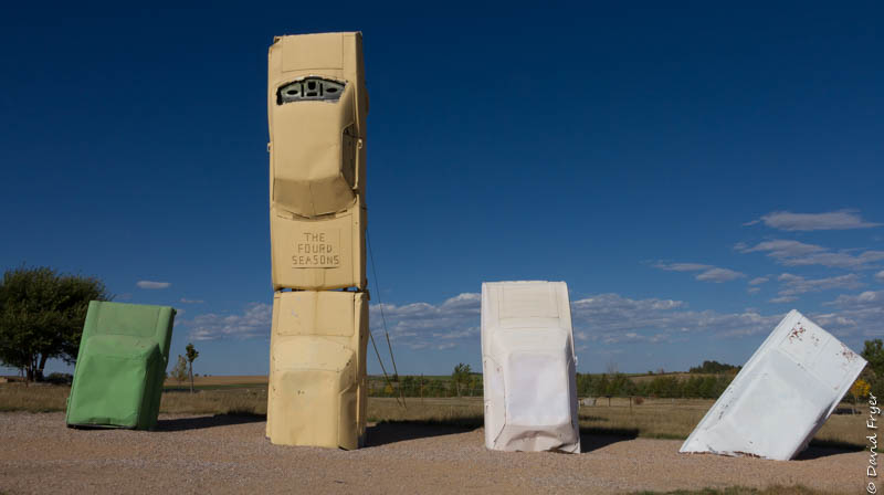
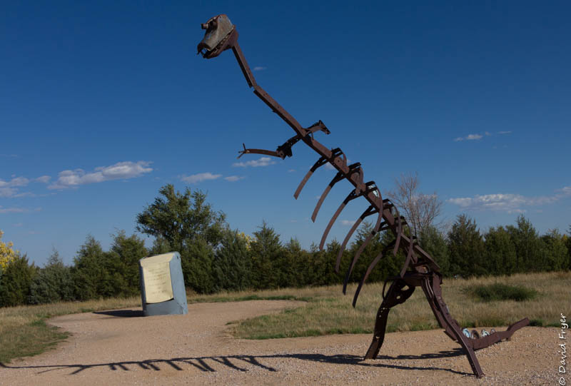
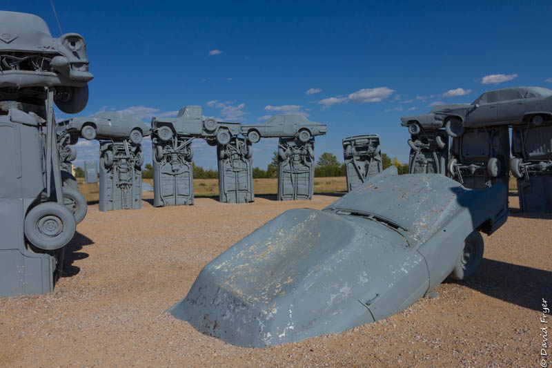
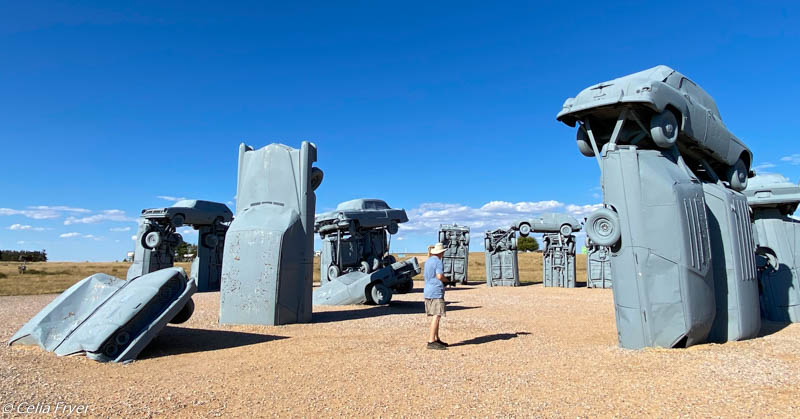
We could not be this close to “Carhenge” and not visit it. It is in the town of Alliance, NE and features 39 old cars configured in a stonehenge array. The family that created this did so during a week-long family reunion! It has become an area attraction with a snack bar and parking lot. Carhenge was dedicated on the Summer Solstice in 1987. It was later gifted to the City of Alliance in 2013.
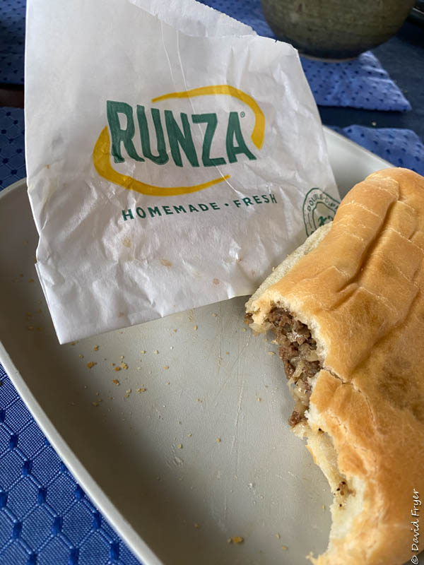
I heard from several folks about a “runza” but I had no idea what that was. Turns out it is a Nebraska regional dish that is a stuffed bread pocket. It is made of beef, cabbage, onions, and various seasonings. There is even a Nebraska chain restaurant that sells these. The Runza restaurant sells many variations of the sandwich including a “philly” style.
Next, we take the Bighorn south to the world’s largest rail classification yard.

We were in this area a few years ago. It was nice to re-visit it with you!
LikeLiked by 1 person