
Once the temperature reached triple digits in Phoenix, David and I decided to head for the hills. Not exactly the hills but to higher elevation where it was cooler.
Our first stop was the town of Payson, AZ which sits at about 5,000 ft. above sea level. The climate was much more pleasant there. The town is surrounded by the Tonto National Forest. The landscape in this area is very different from that of southern AZ. There are no saguaro cacti or palo verde trees but rather many stands of Ponderosa pines. This area reminded us of some parts of central Oregon.
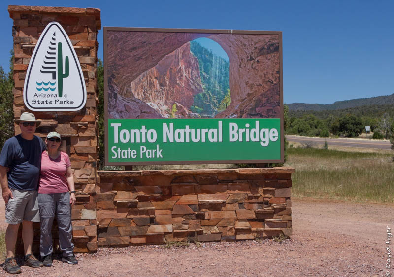
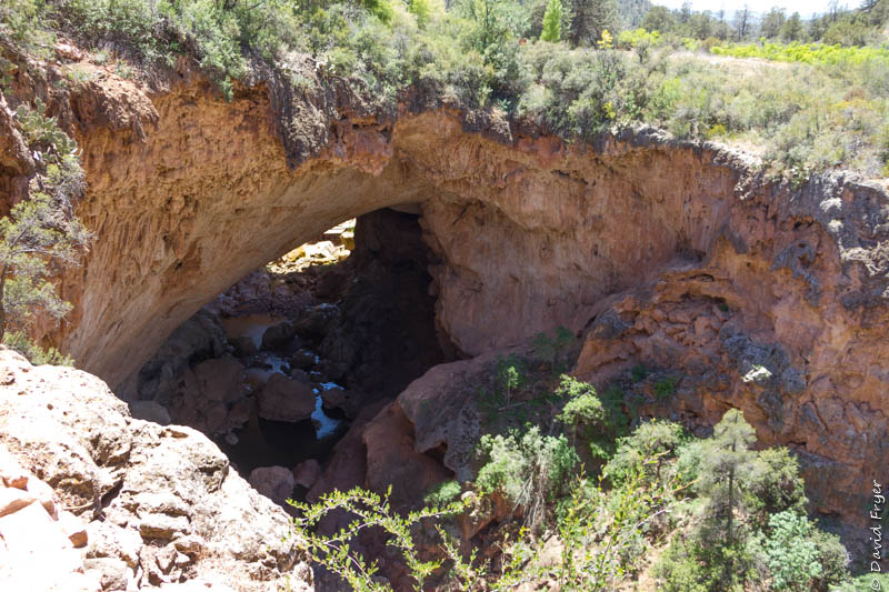
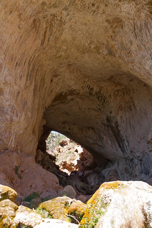
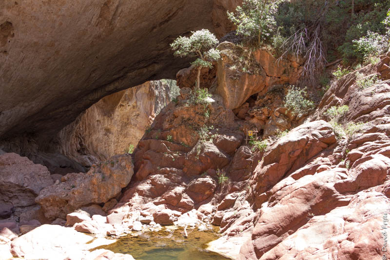
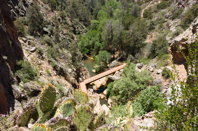
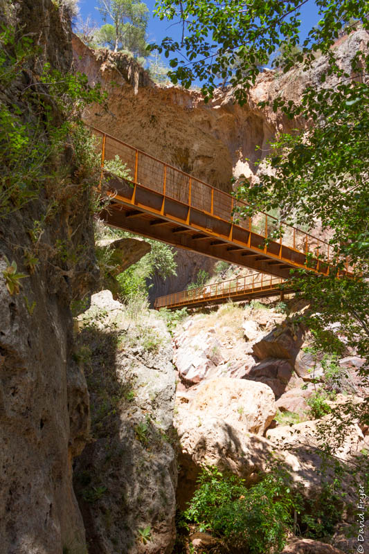
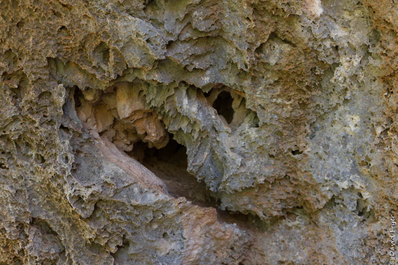
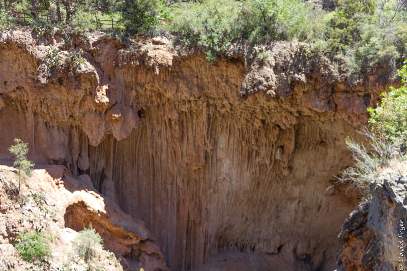
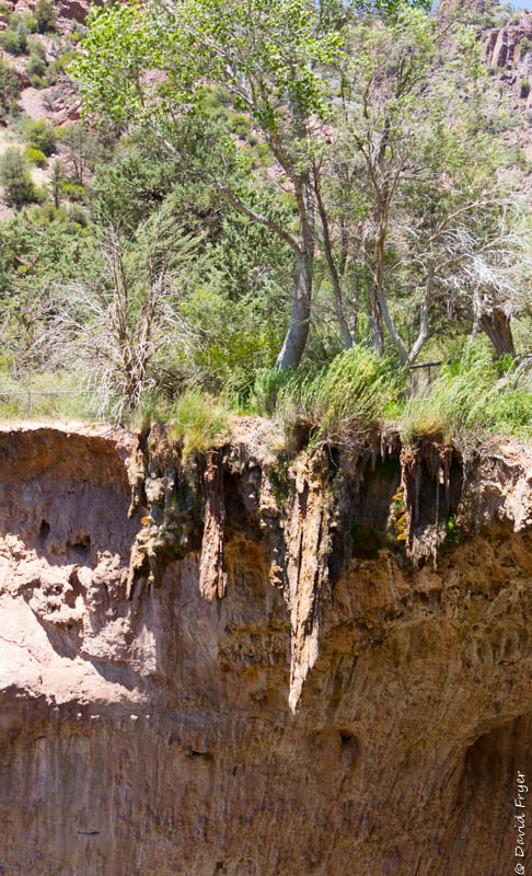
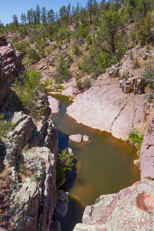
We made a day trip to Tonto Bridge State Park which is about 20 minutes northwest of Payson. This park boasts the largest travertine bridge in the world. The tunnel under the bridge is 393 feet long, 150 feet wide, and 183 feet tall. You can view the bridge from four viewpoints on the rim but the best way to take it in is to hike down to the mouth of the tunnel. There are two trails that will lead you to each end: the Gowan Trail and the Anna Mae Trail. Both are steep and the latter requires scrambling over rocks to reach the entrance. The Gowan Trail, while just as steep, has a metal bridge at the bottom that leads to an observation deck. There is a path that goes through the tunnel but keep in mind that the rocks are very slippery. During our visit at the park we went to all the viewpoints and hiked both trails mentioned above. Be sure to wear sturdy shoes and bring lots of water when you come to the park.
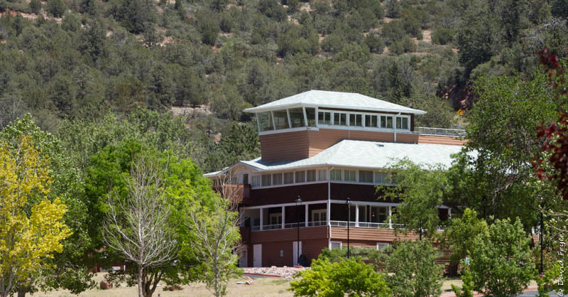
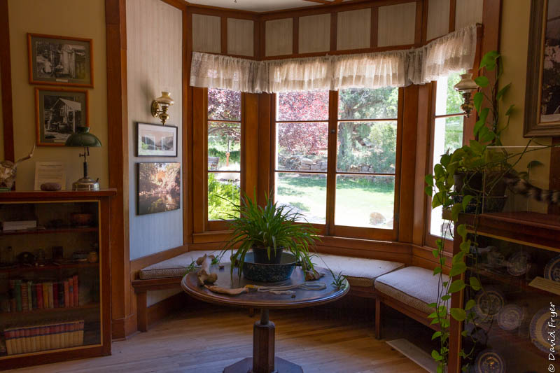
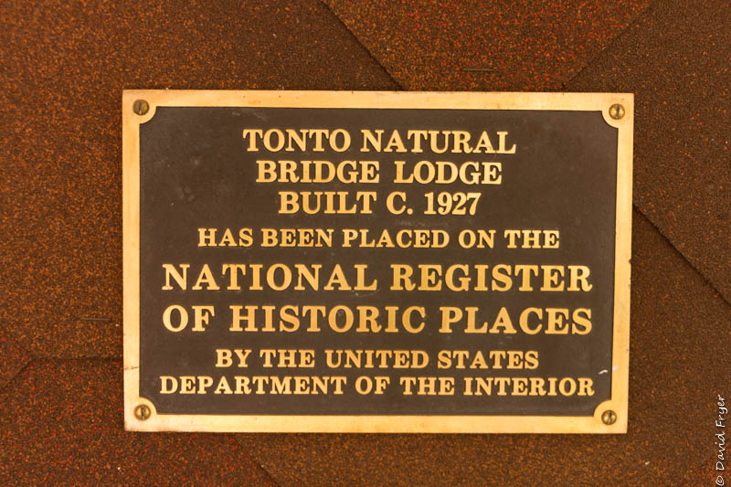
Also found in the park is the historic Goodfellow Lodge. This building was built in the 1920s and still has its period charm. It is currently not open for overnight stays but it has 10 rooms and is a venue for weddings and other events. The lodge is also the location of the visitor registration office.
There are several more trails in the park that we did not hike as well as a gift shop and large picnic areas. We had a nice time exploring this small state park.
One final note about this park: the road leading down to the park has a 14-18% grade. It is recommended that you “drop” your tow vehicle in the “trailer drop off area” before descending.

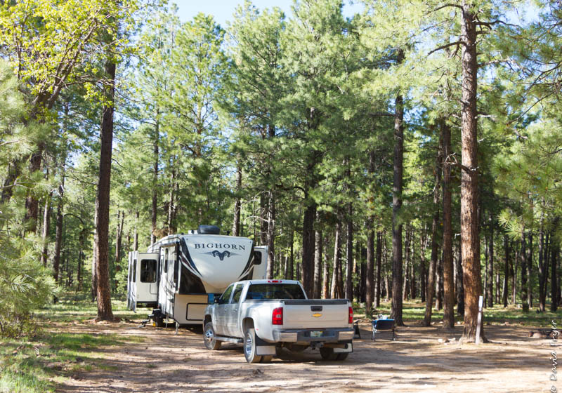
After spending a few days in Payson, we drove to the Mogollon Rim. We have wanted to go there since our friends, Sally and Peter, told us about it years ago. We decided to boondock on the rim and were joined by our friends Rick and Theresa. We liked it so much that we stayed there for five days.
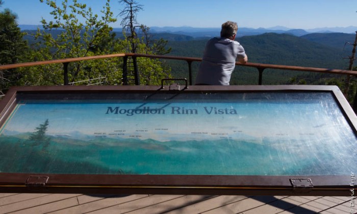
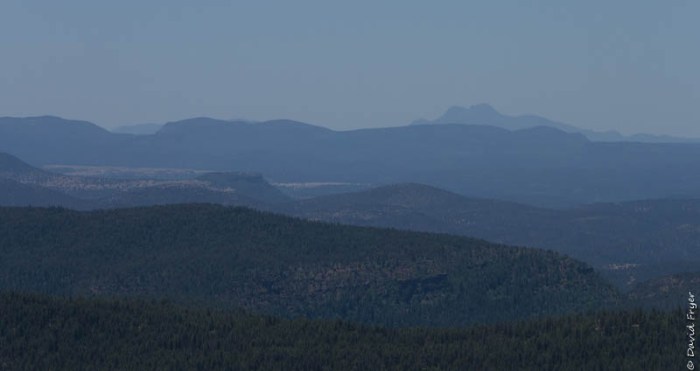
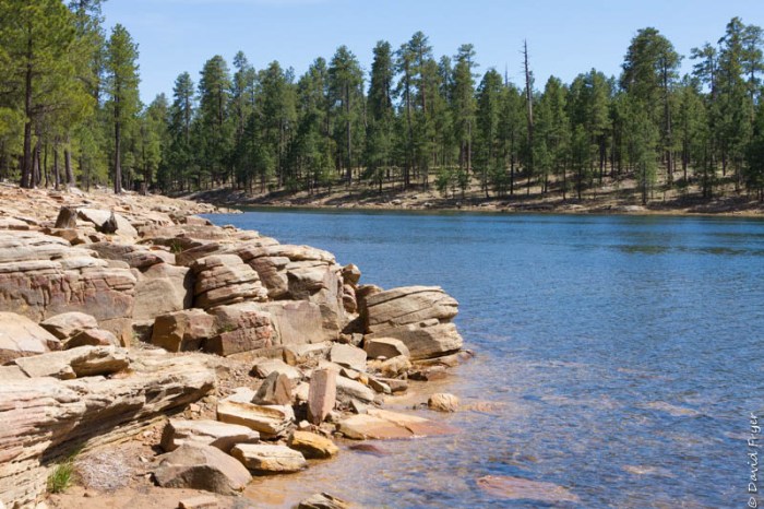
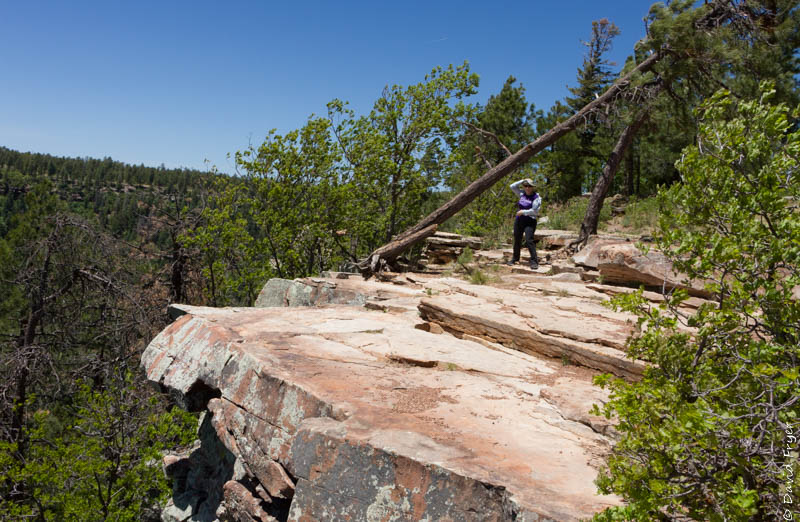
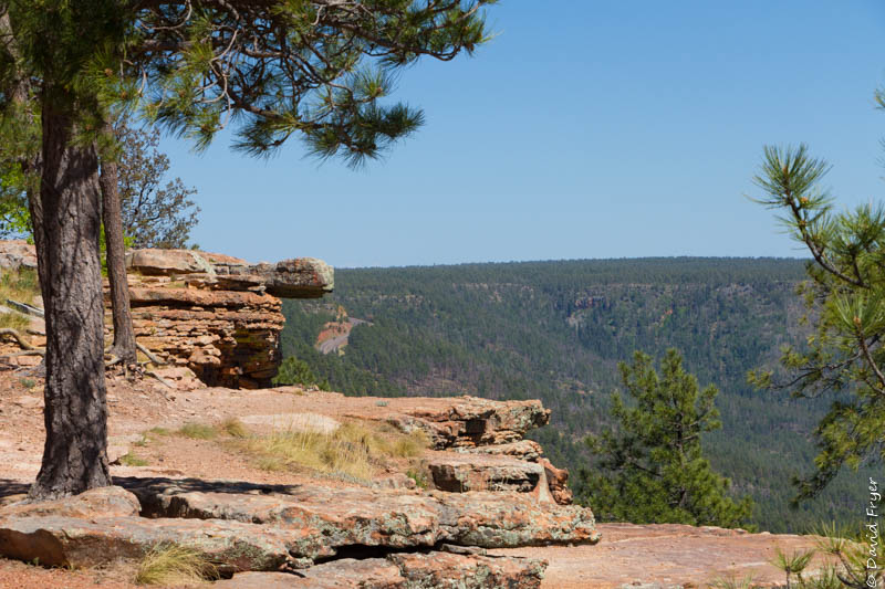
The Mogollon Rim is an escarpment that extends about 200 miles west from the New Mexico border to central Arizona. The base of the escarpment is about 4,000-5,000 feet above sea level and it rises to 8,000 feet. Although this geographic feature was named for Don Juan Ignacio Flores Mogollón, the Spanish governor of New Mexico from 1712-1715, the people do not pronounce “Mogollón” as the Spaniards would. We found that people pronounce the name of this place several different ways; some say it sounds like “Maa-guh-luhn” while others say it should be “Muggy-Yawn.” Whatever its called, the views from the Mogollon Rim’s limestone and sandstone cliffs are breathtaking.
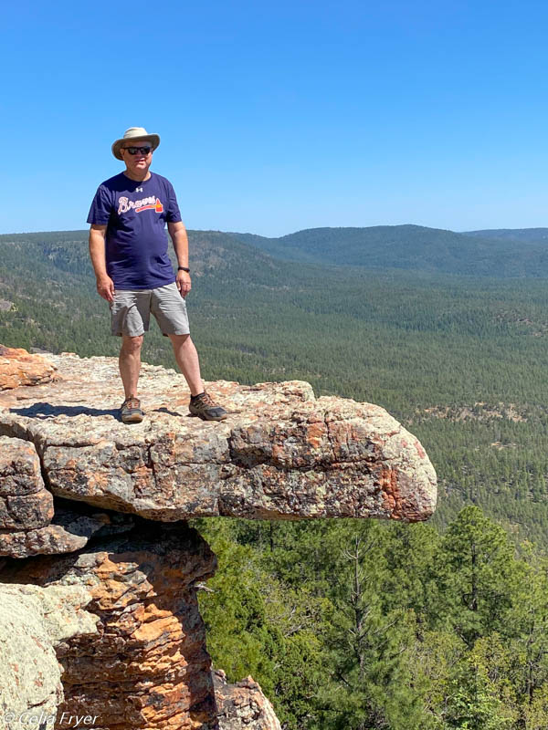
We went to several overlooks and also hiked part of the Rim Trail. We were very surprised by how windy it could get right at the edge of the rim. When a gust came up, it was often hard to keep your hat on or stand. Away from the rim, the wind was not nearly as strong. We now understand why so many people in the Phoenix area come up to Mogollon Rim in the summer because it offers cooler temperatures, great views, and many recreational activities.
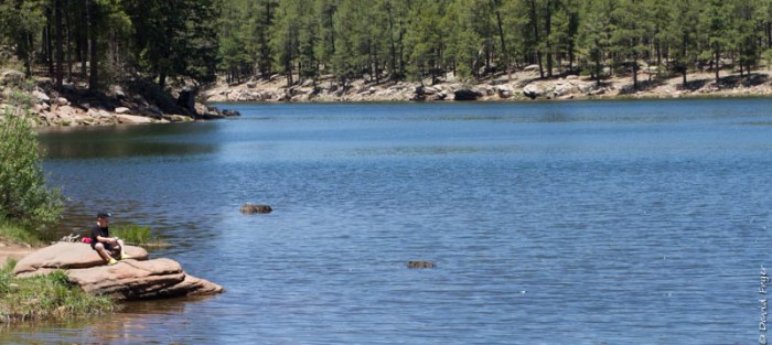
On the Mogollon Rim, there are a number of small lakes, called Rim Lakes, that attract fishermen and boaters. Several people told us that the water was too cold to swim in now but it might warm up later in the season. There are also miles of hiking and biking trails to enjoy.
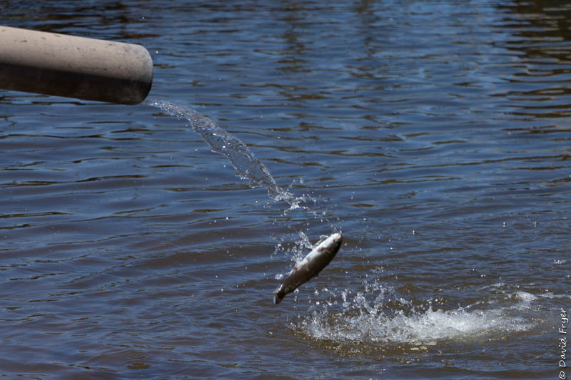
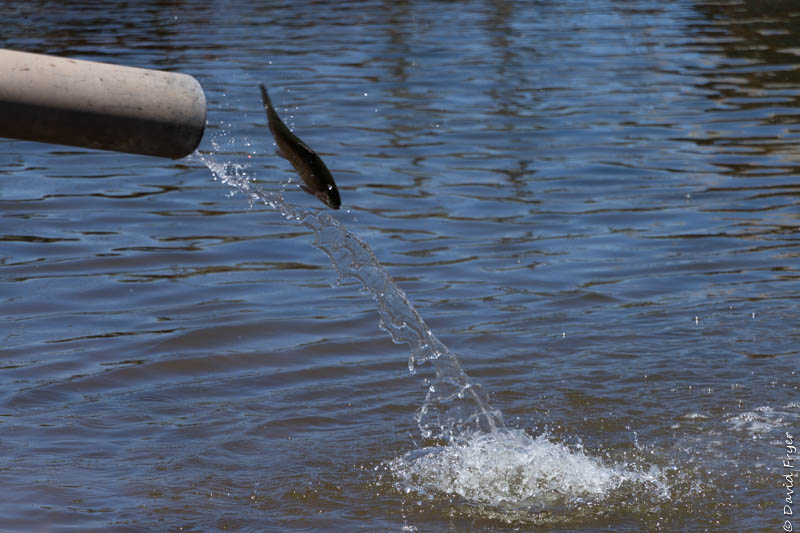
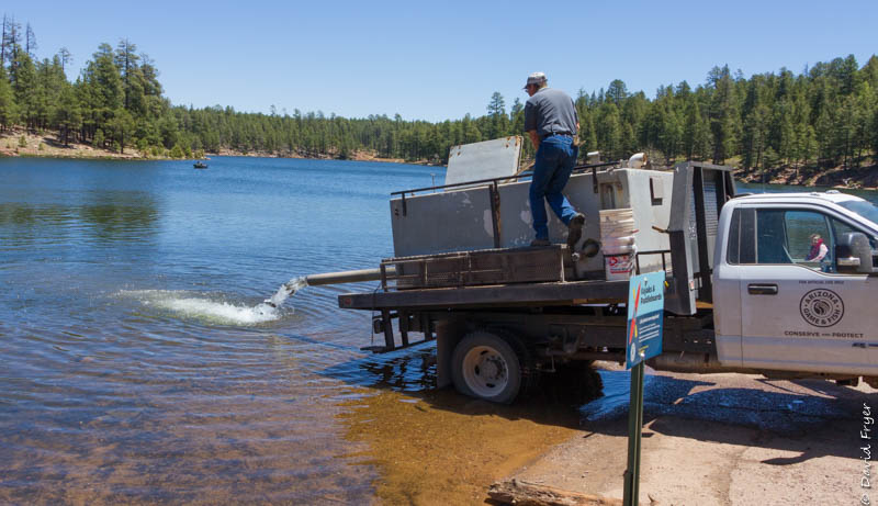
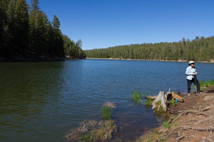
We were camping near both the Woods Canyon Lake and Willow Springs Lake. Both are small but they are very picturesque. The Woods Canyon Lake covers about 55 acres and is stocked regularly with rainbow trout. We were lucky enough to see how they introduced the trout into the lake. The rangers have a truck with a large holding tank in the bed of the truck. There was long tube attached to the tank that hung off the back of the truck over the water. When the ranger opened the valve, the fish came pouring out. Our friends said that sometimes they airlift the fish and drop them into the small lakes. The fishermen who were there were very excited because the odds of catching some fish just increased significantly. It was entertaining to watch the process of restocking the lakes.
Before leaving this lake, we hiked some of the trail that circumnavigates the lake. Unfortunately we found that it was not as well maintained as we had hoped but it did provide us with some lovely vistas of the lake.
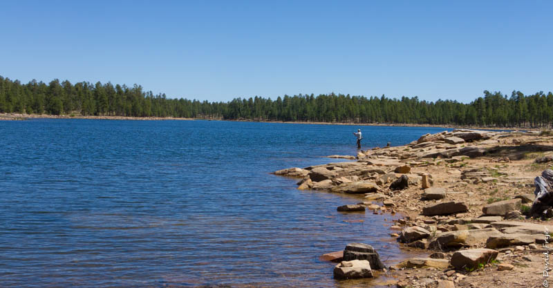
Later we drove to Willow Springs Lake which is not far from Woods Canyon Lake. This lake is larger and deeper than the other one. It covers about 158 acres and is about 60 ft. deep. Interestingly, this lake does not have a dam or water input. It relies on snow melt to furnish the water. This year there must not have been a lot of snow because the water level seemed low and you could see much more of the lake’s rocky shoreline. The fishermen did not seem to mind it because we saw several when we were there. Since neither lake allows motorized boats, it was a very peaceful place to spend some time.
Another afternoon, we drove 12 miles down a gravel road to check out another rim lake, Bear Canyon Lake. It was about the same size as the Woods Canyon Lake but it was more difficult to access. When you arrived in the parking lot, you had to hike down a steep trail to reach the water. We encountered a few fishermen and some paddleboarders who were hiking back up to the parking lot. Hauling paddleboards up and down that trail did not look like much fun to us! The lake itself was lovely but getting to it was much more difficult than getting to the other two lakes and the others were just as nice.
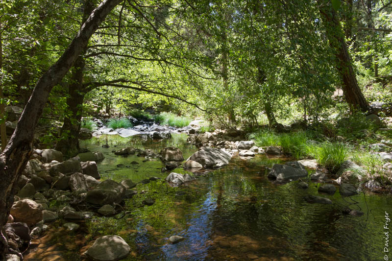
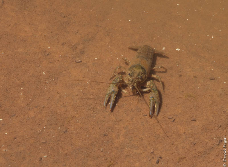
The final place that we explored with our friends was the Christopher Creek area which is at the base of the Mogollon Rim. We went to the Christopher Creek campground and hiked along the creek. Unfortunately, the trail was not well marked. Fortunately, others had been there before us so we looked for their footprints. We did see some bucolic scenery and spotted some large crayfish in a pond. After our trek, we ate lunch in their picnic area. While there we saw two boys who had snagged 6 rainbow trout from the stream. The youngest, who was about 10 years old, was so excited because as he said, “I caught the biggest one!” His older brother confirmed his claim and even showed us the fish. It’s always fun to see families out together enjoying nature.
We had five fabulous days exploring the Mogollon Rim. Thanks to Theresa and Rick for coming with us and for ferrying us around. Hope we can meet up again soon!
P. S. – David is slowly improving from the Bell’s Palsy. His symptoms are less noticeable and less aggravating now. We are hoping that he will make a full recovery in a few more weeks. Many thanks to all for contacting us and for your well wishes for David.

These sound like some great places to visit that we haven’t been yet! I’m so glad to hear David is improving and that you’re able to do the things you are. Also wonderful you got to spend time with Rick and Theresa.
LikeLiked by 1 person
Good to hear from you. Thanks to both of you we were able to meet Rick and Theresa. We had a lot of fun boondocking together. We were at 7,700 feet so it was considerably cooler than the Mesa area.
LikeLike
The lakes and the Mogollon Rim are beautiful. If we get to Arizona again, I hope we can visit some of them, especially the rim (though I am not sure I am as brave or sure footed as you, David–I would peruse the rim from a greater distance that you). I am so glad to hear that David is getting better–I will share this with the class tomorrow (if my old brain remembers!). Thanks for both the pictures and the narrative.
LikeLiked by 1 person
Not that brave!
LikeLike
The Mogollon Rim! I’m saving this one. Looks exceptional. Let’s go boondocking again!
Glad to hear David is doing better. This stuff takes time, sometimes (or should I say usually) more time than we would like.
FYI…I’ve started going through David’s Alaska notes in preparation for next summer. 🙂
LikeLiked by 1 person
Hope everything works out for a trip to Alaska. It is one of our best trips. I am sure that you can tell the vistas are incredible and the people very friendly.
LikeLike