
Leadville is on the Top of the Rockies Scenic and Historic Byway. This scenic byway is one of 53 roads in the United States that have received this designation. The Top of the Rockies Scenic and Historic Byway is a 75 mile stretch of highway which includes sections of Hwys. 24, 91, and 82. It begins in Aspen and crosses over the Continental Divide to Twin Lakes, then turns north passing through Leadville. At that juncture it goes north to Copper Mountain and to Minturn. The byway rarely drops below 9,000 feet as it weaves through some of the most idyllic parts of Colorado’s high country. While David and I did not drive all 75 miles, we did cover a significant part of it as we explored different sites around Leadville.
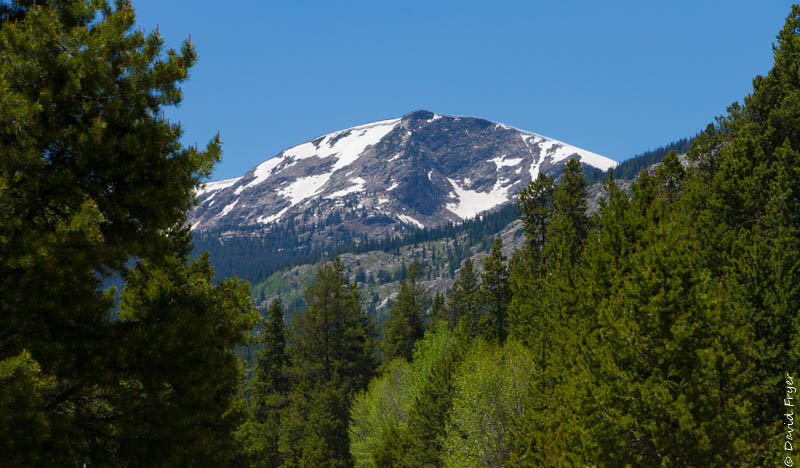
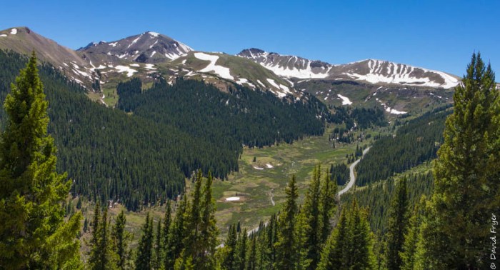
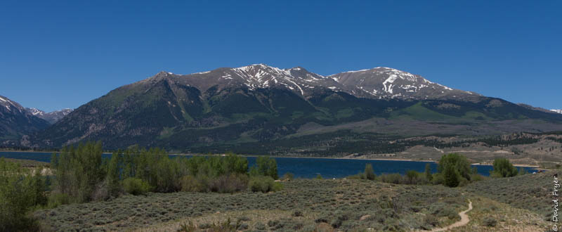
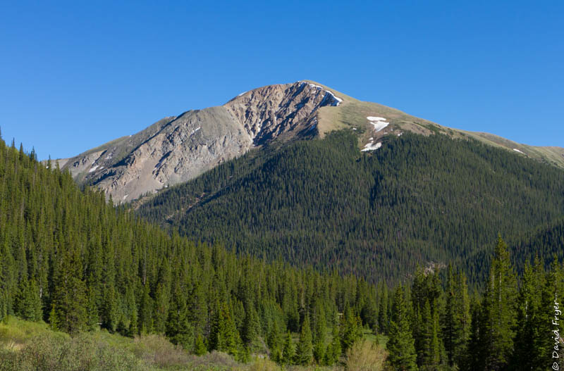
Along the Top of the Rockies Scenic Byway near Leadville, you can see the snow-capped peaks of Mt. Elbert (14,433 ft.) and Mt. Massive (14,421 ft.), the two highest mountain peaks in Colorado and in the Rocky Mountain range. In fact, our boondocking spot had views of Mt. Massive and was one of the best places we have stayed.
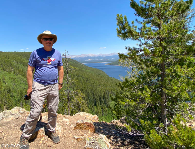
About 15 miles south of Leadville on Hwy. 82 are two lakes called Twin Lakes. These glacial-formed lakes are surrounded by beautiful mountains. The Twin Lakes are about 100 feet deep and cover about 4.2 square miles. Today both lakes are much deeper than they were in 1897. That year they built a dam to create a reservoir and they also dredged a canal between the two bodies of water to connect them. Later, in the 1970s they built the Mt. Elbert power plant to produce electricity. The U. S. Forest Service manages most of the land around Twin Lakes. Many people come to Twin Lakes for recreation like fishing, canoeing, kayaking, and hiking. There are five campgrounds and some dispersed camping around the lakes. We saw many fishermen and some kayakers out on the water while we were there.
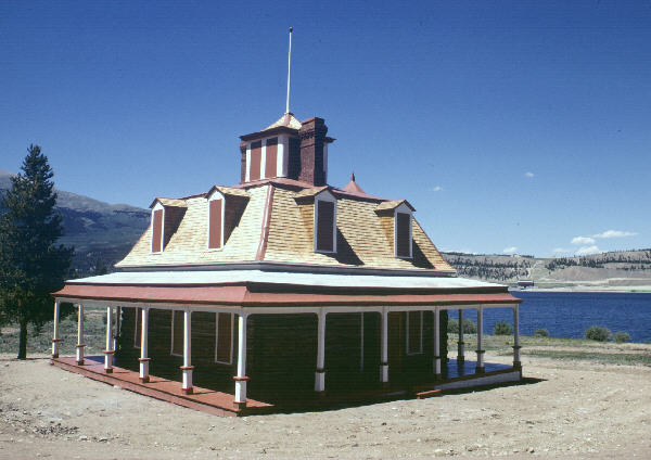
Another point of interest on the other side of Twin Lakes is the Interlaken Hotel and Resort which was erected in 1879. It was a popular destination that featured fountains, a dance pavilion, and an indoor outhouse. The Dexter Cabin is part of this complex as well. The U. S. Forest Service maintains the site but it can only be reached by biking, hiking, or boating to the historic location.
Originally, the town of Twin Lakes, which is located on the west end of the lakes, was called Dayton. When gold was discovered in the 1860s, Dayton became the county seat. The Colorado legislature renamed the town Twin Lakes. Nineteen years later more gold was discovered near the Continental Divide and Independence Pass. With that discovery, a company set up a toll road and a stagecoach route between Leadville and Aspen. Twin Lakes became a hub of trade and transportation. Given the town’s historical significance, it has been listed on the National Historic Register.
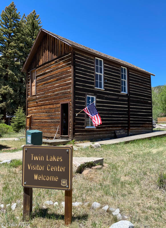
There are still many buildings in the Village of Twin Lakes that date back to the 1870s. There is a walking tour if you want to take a stroll back in time. One of the historic buildings also serves as the town’s Visitor Center. The Red Rooster Visitor Center, which was constructed in the 1870s, served as a general store, tavern, hotel, and brothel over the years. It was here that we talked to a docent that was volunteering there. After talking with him for a bit, we both realized that we had taught together at the University of Richmond many years ago. It was good to see him again. It is a small world!
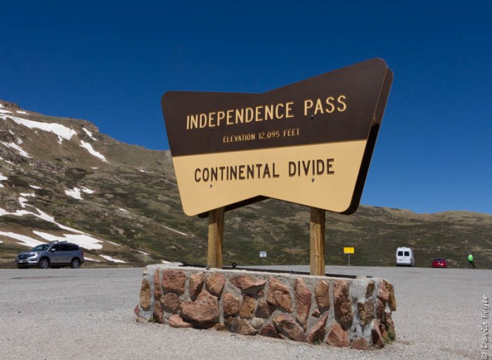
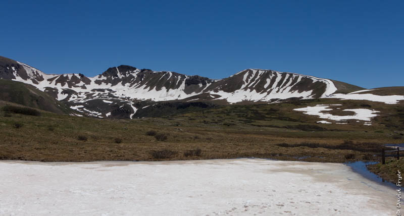
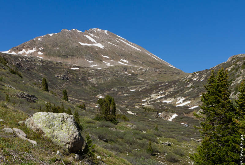
After getting some suggestions, information, and maps we set out for Independence Pass. About equidistant from Aspen and Twin Lakes is Independence Pass. To reach this pass at 12,095 ft. on the Continental Divide of the Sawatch Mountains, you must drive up a windy mountain road. It is the highest paved road crossing the Continental Divide and much of it follows the old stagecoach route so there are several switchbacks and places where the road narrows. In winter, it is impassible. It only opens from the end of May through October (weather permitting).
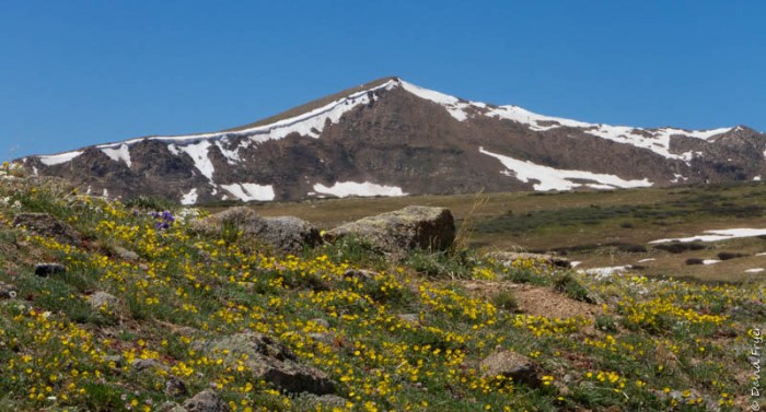
At Independence Pass, the views of Mt. Elbert and the alpine tundra are impressive. There are paved walkways to several overlooks. There are also some trails that allow you to explore more of the area. Due to the elevation, it can be very cold and windy so you should come prepared with a warm jacket.
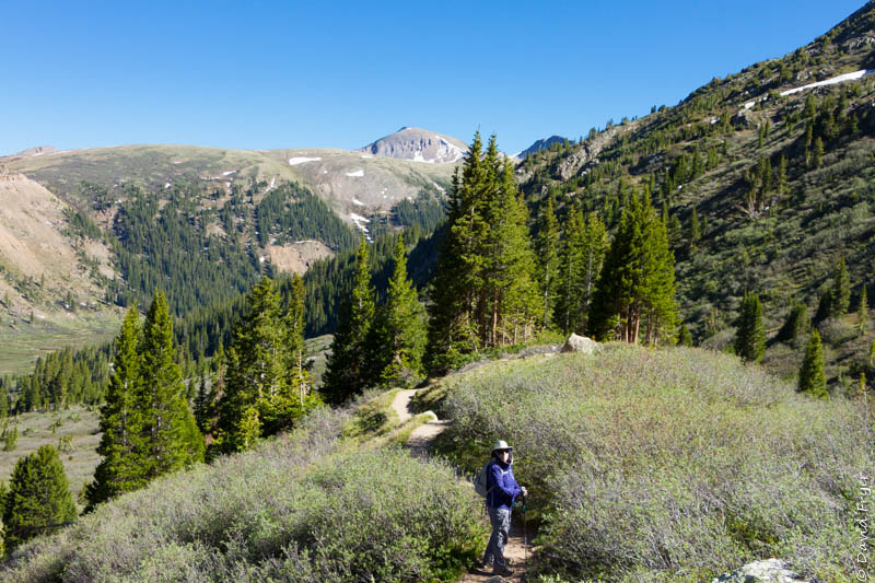
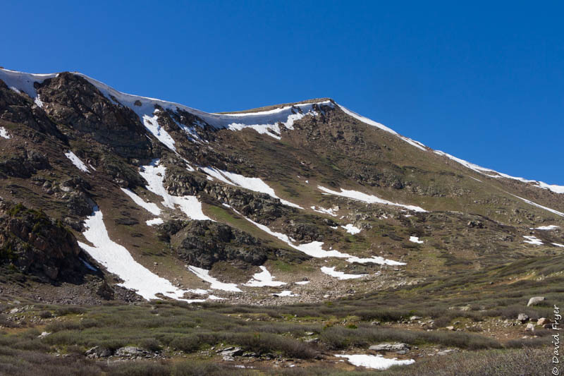
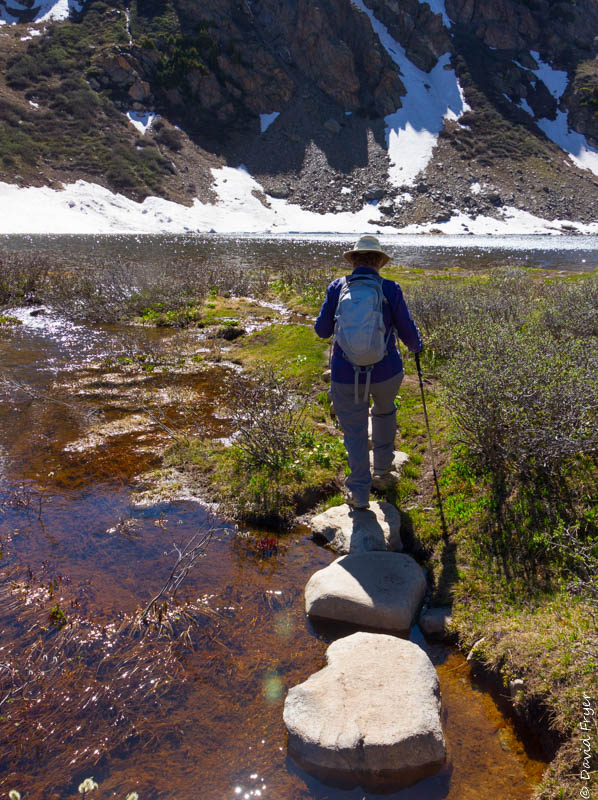
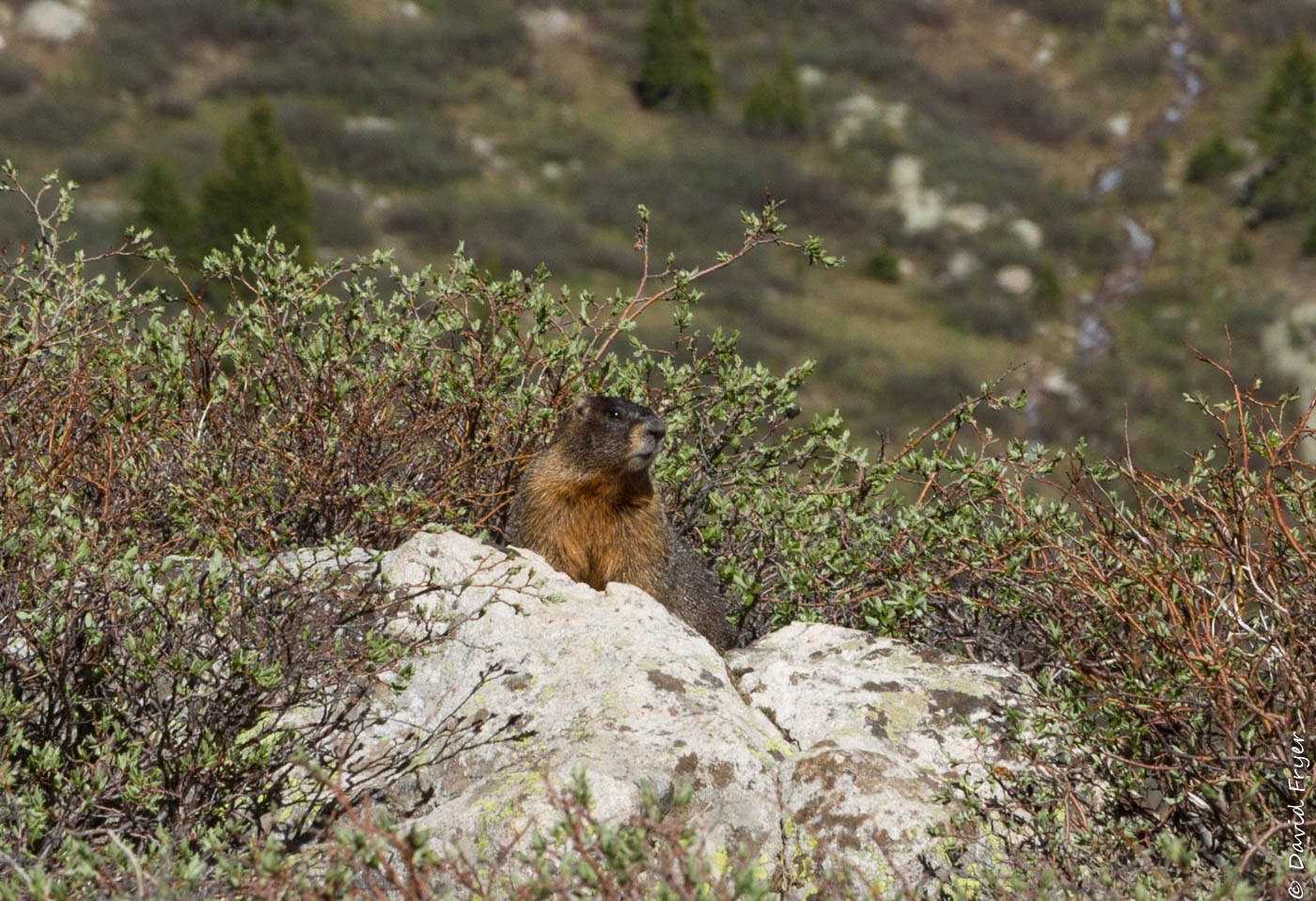
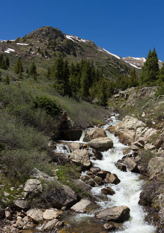
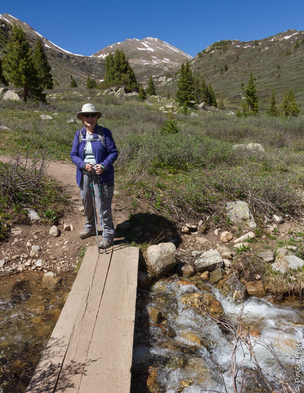
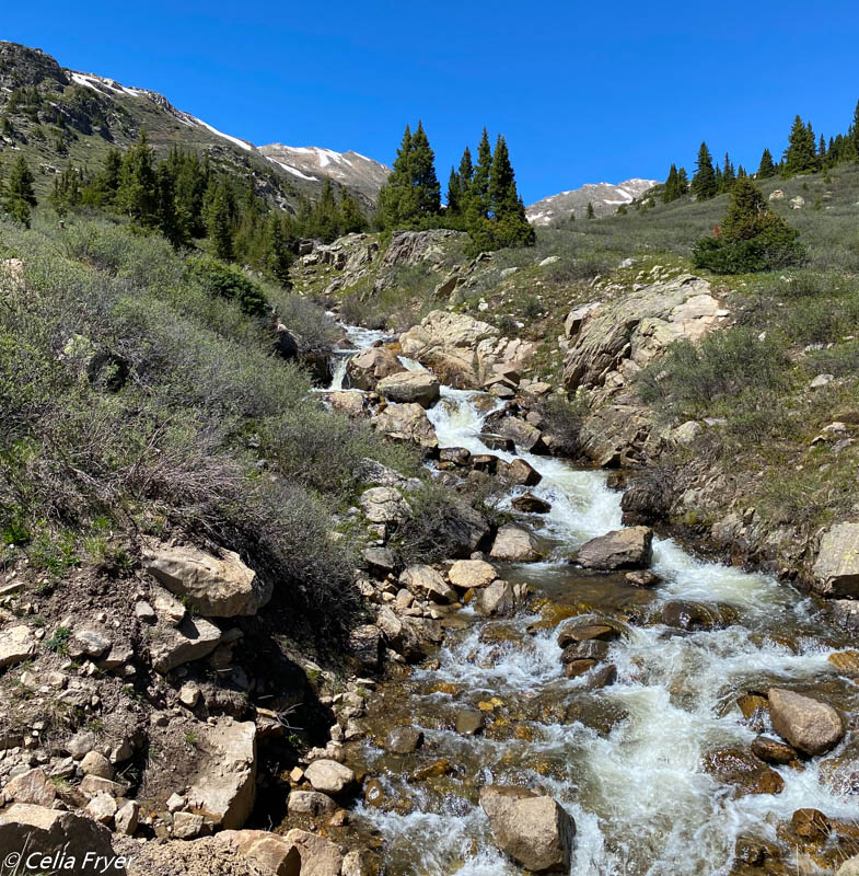
After spending some time soaking up the beauty of this summit, we continued on a bit farther toward Aspen. We were in search of the Linkin Lakes Trail in the Hunter Fryingpan Wilderness. We parked at the trailhead area for Linkin Lakes, Independence Lake, and Lost Man Lakes trails. We met several hikers who were returning from attempting to reach Lost Man Lakes but they had encountered thigh deep snow so they turned back. We chose a shorter 1.6 mile hike which for us was rather challenging due to the elevation gain and the elevation of the trail. We definitely had to stop multiple times to catch our breath but we did not mind since there were some amazing views of the mountains and valleys below. We did cross a snow field and several fast running streams on our way up to the lake. At the end of the trail, we were rewarded with a pristine alpine lake. While we rested and ate a snack before descending, a marmot stopped by to check on us. He was a very large marmot!
We had a great day soaking in the spectacular scenery along the Top of the Rockies Scenic Byway on Hwy. 84, the Continental Divide, and the surrounding wilderness areas.
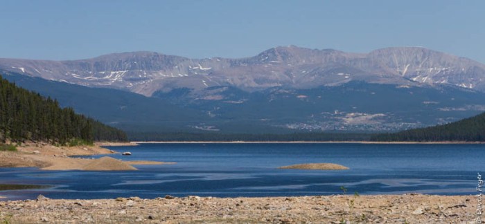
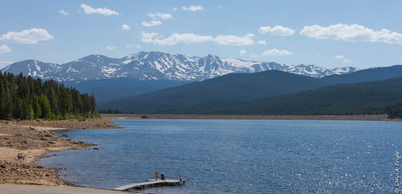
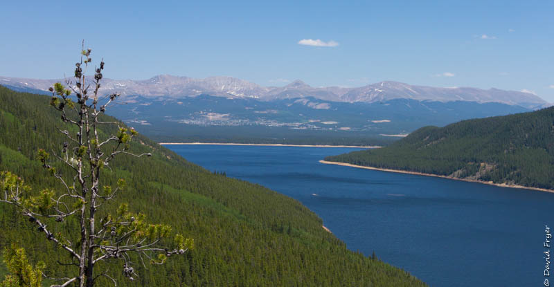
Another day we circumnavigated Turquoise Lake which is also part of the Scenic Byway route. This lovely lake is about four miles from Leadville and is a favorite place for the local residents. Named for the turquoise deposits nearby, this lake was formed in the 19th century when they built a dam. The lake covers 1,800 acres and is a lovely shade of blue. Along its shores are several campgrounds named for gold and silver mines and famous mining tycoons. Molly Brown, Baby Doe, and May Queen are just a few of them. In summer, many boaters enjoy getting out on the lake and there are fishermen seemingly everywhere. Many trails crisscross the mountains around the lake providing wonderful views of the lake. In winter, people snowmobile, snowshoe, or, since the lake freezes over, ice fishing. Turquoise Lake is a great place for recreation and reflection.
As we departed Leadville, we drove another section of the Top of the Rockies Scenic Byway up to Copper Mountain. Atop the Freemont Pass (11,318 ft.) is the Climax Molybdenum Mine, the largest underground mine in the world. The molybdenum, or “moly,” extracted from the Climax Mine is essential to technology. It is used in cars, homes, buildings, infrastructure, and much more. Farther north, the Scenic Byway took us by the Clinton Reservoir and the Copper Mountain ski area. It was a beauty-filled drive.
This was the first time we had visited Leadville and the Top of the Rockies Scenic Byway. David and I agree that the time that we spent here only gave us a taste of the area. We hope to return again and spend more time here in this extraordinarily beautiful part of Colorado.

Wow. Says it all 😊
LikeLiked by 1 person
It is a beautiful area. We are so glad that we visited this town. It was hard to leave!
LikeLike
Just beautiful! Your pictures remind me of Colorado’s beauty. We don’t boondock, but your boondocking spot is the best commercial yet. Love the phrase, regarding the lake, – for “recreation and reflection.” Thanks for your post!
LikeLiked by 1 person
When the scenery is beautiful it is easy to take photos.
LikeLiked by 1 person
Loved it.
LikeLiked by 1 person
We used to ski Copper Mountain years ago. This post brings back wonderful memories of the area!
LikeLiked by 1 person