
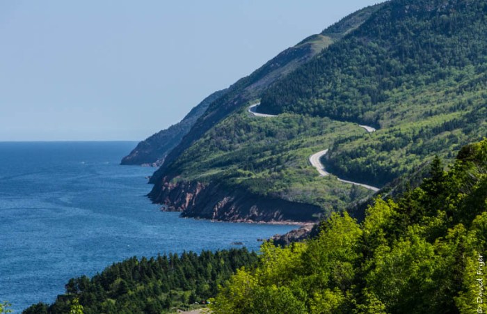
One of the main reasons that people come to Cape Breton is to drive the scenic Cabot Trail. We were no exception. We went to the Visitor Center in Baddeck and were told that to see all the vistas you really should drive the loop road twice: once clockwise and another counterclockwise. Our original plan was to drive up and back down the west side and then on another day drive up and down the east side. Well, as it turns out, we did drive it once clockwise and then drove up and back down the eastern coastline another day.
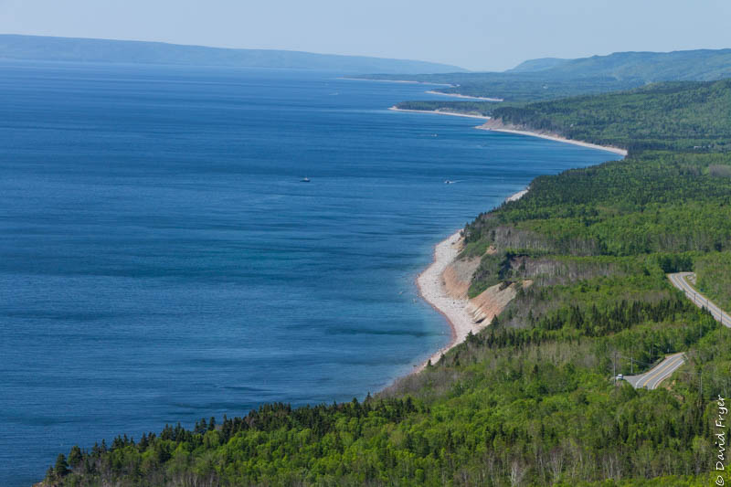
Named for John Cabot who explored Atlantic Canada in 1497, the Cabot Trail is an 185 mile-long loop road in the northern part of Cape Breton Island. The road winds its way up both of the island’s coastlines and through the Cape Breton Highlands and the Cape Breton Highlands National Park. There are two entrances to the National Park: one in Cheticamp and the other in Ingonish. There is a Visitor Center at each entrance. It takes about 4 hours to drive the Cabot Trail without making any stops but, of course, we stopped at most of the overlooks and did some hikes along the way.
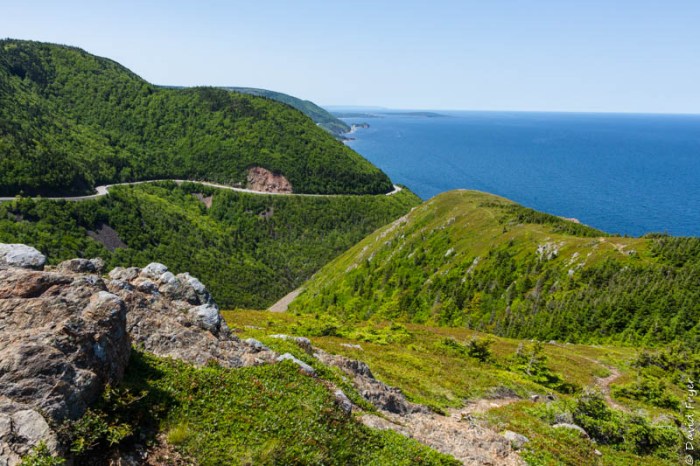
The best known hiking trail in the area is the Skyline Trail. Located near Pleasant Bay, NS, this hike is a 4 mile out and back or a 5.9 mile loop that takes you to some breathtaking view of the Gulf of St. Lawrence and it was a “must do” for us.
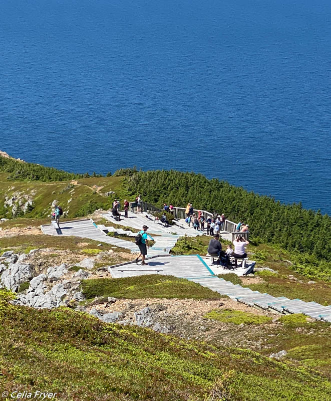
When we arrived at the main overlook, there was a boardwalk and a long series of steps and landings that allowed us to walk out on the headland. Going down wasn’t too hard but the trek back was challenging! Glad there were places where we could stop for a bit.
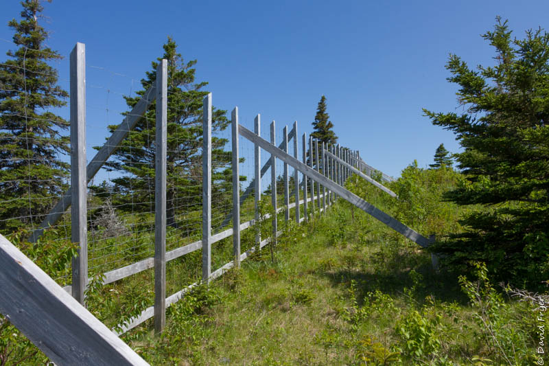
Along the trail, we saw sections that were fenced off. The moose (yes, there are moose there!) have eaten the young trees and shrubs so Parks Canada is trying to protect the boreal forest by fencing off certain sections to give it a chance to regrow. In fact the moose population has grown exponentially in recent years since they have no major natural predators in the area to keep their numbers in check. Per Parks Canada, there are four times more moose than the forest can support. Consequently, there is an ongoing debate as to whether to allow the hunting of moose in Cape Breton. We saw signs like “Save the Moose” along the Cabot Trail so there is clearly some opposition to this proposal. We are not sure what they will decide to do but the presence of so many moose is turning the forests into grasslands.
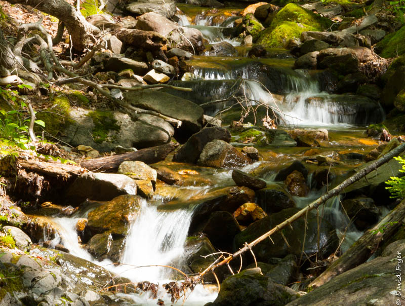
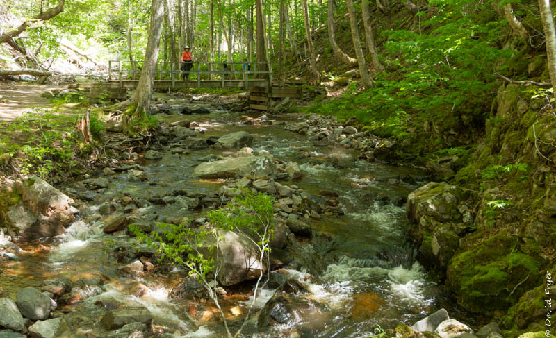
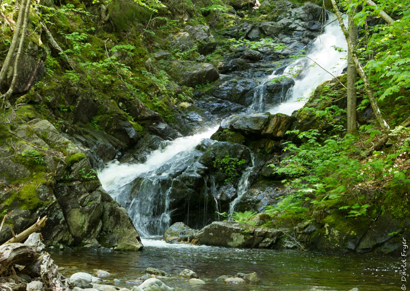
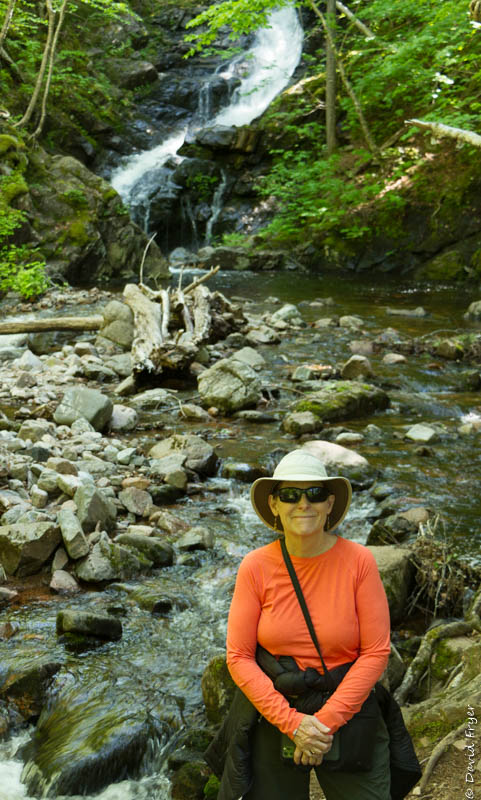
A little farther inland near Red River, NS is the MacIntosh Brook Trail. It is a short trail that follows one of the river canyons though some old-growth forest. Although it was a bit buggy, we followed a lovely brook and were rewarded with a gushing waterfall at the end of the trail.
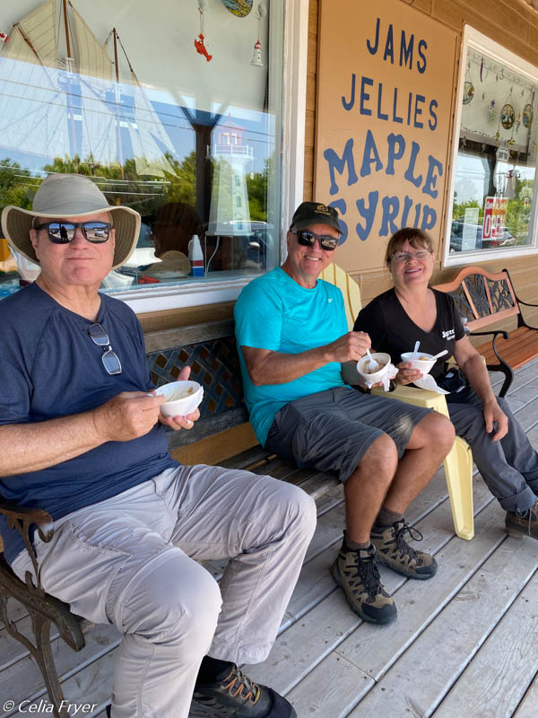
Along the Cabot Trail there are places to stop for ice cream and we couldn’t resist. One of the patrons eating ice cream was excited to be in a place that did not have a Tim Hortons or McDonald’s for miles.
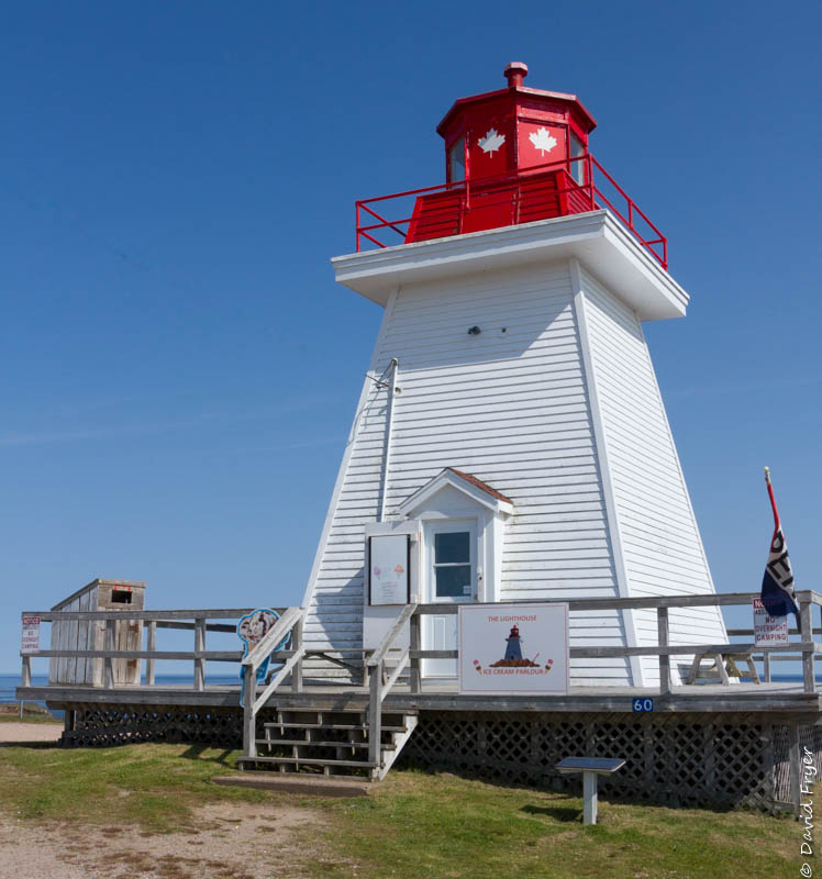
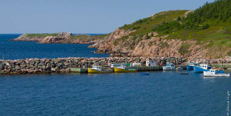
We took a short detour off of the Cabot Trail to see the Neil’s Harbor Lighthouse. Surprisingly they also serve ice cream inside the lighthouse itself. What a perfect combination!
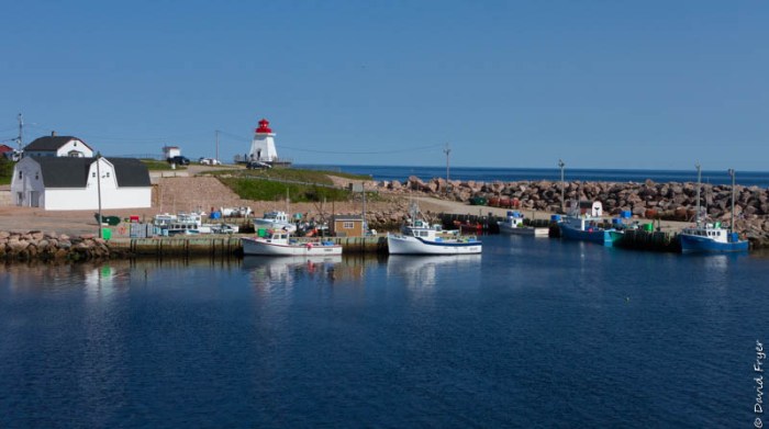
Built in 1899, this 34 ft. square wooden lighthouse watches over the town of Neil’s Harbor which originally was a fishing village in the 1850s. Today it offers great views of the Atlantic Ocean and is a popular tourist attraction.
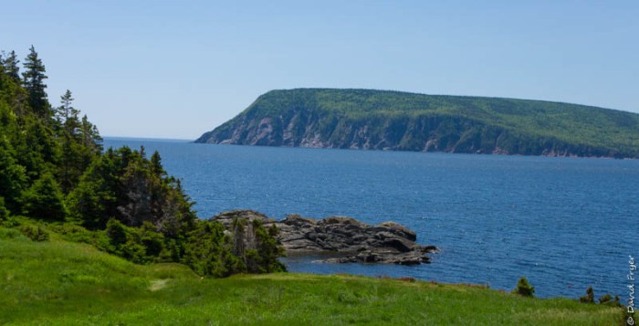
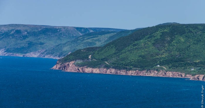
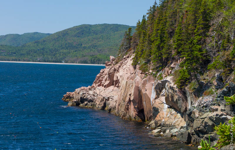
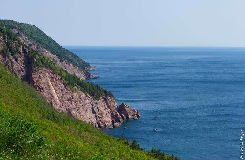
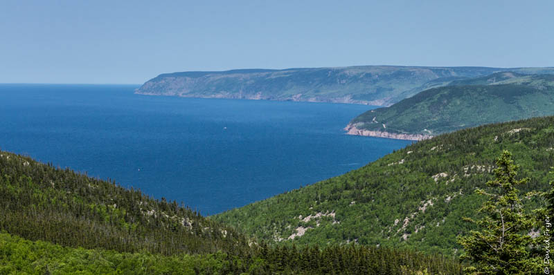
Another day we returned to the eastern part of the Cabot Trail because we wanted to spend some more time there. We found that the eastern coastline was more dramatic and scenic and it was our favorite.
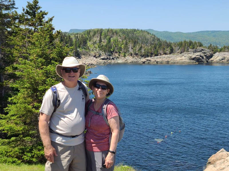
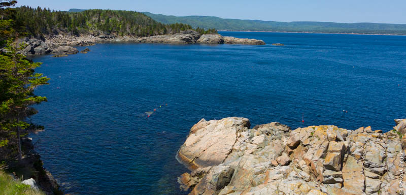
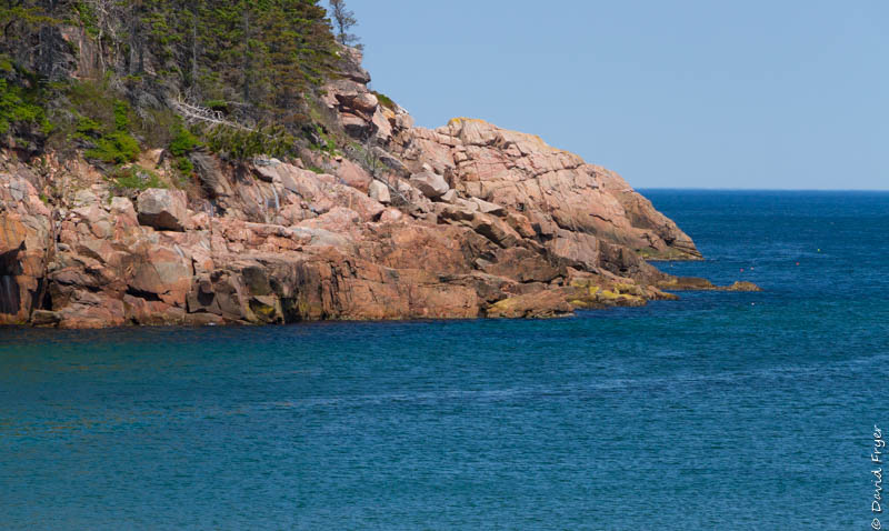
We decided to hike the popular 2.4 mile Middle Head Trail. The trail head is a bit tricky to find because it is tucked behind the Keltic Lodge, which is owned by Parks Canada. Once we found the start of the trail, it was pretty easy to follow. The trail follows the crest of the peninsula and it offers great views of the Atlantic Ocean, Cape Smokey, and Ingonish Island. It is rocky in places and there are some exposed roots so be sure to wear some sturdy shoes. Celia was glad that she had her walking poles, too. We hiked through some forested areas and some open grassy areas. At the end of it, there are some cliffs and lots of seabirds everywhere. The water below was a deep blue color and we could hear it crashing against the rocks below. When we reached the point, we stopped for a while and ate a snack and took in the amazing view. We really enjoyed hiking the Middle Head Trail.
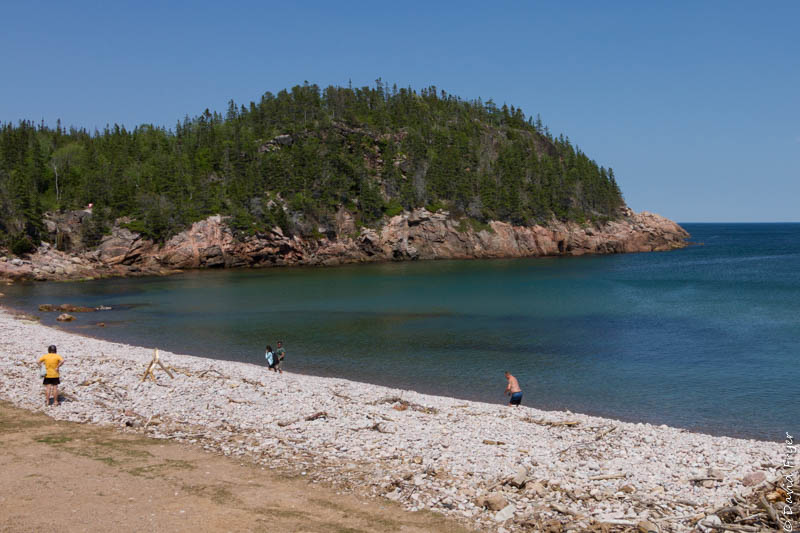
Ingonish Beach is another popular area. There were people in bathing suits and a few were even swimming in the cold North Atlantic waters. It was a beautiful, yet rocky, beach with a waterfall off to the left. For us, the water was too cold for us to even consider going swimming but but our friend Paul did venture out into the Atlantic Ocean but he did not stay in the water very long. It was cold!
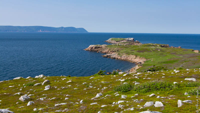
Our final stop was at White Point which is just outside of Cape Breton Highlands National Park. The White Point Trail is a 1.5 mile out and back to a very barren peninsula. Once there, we could see Neil’s Harbor and South Harbor. It was very windy but the expansive views of the rugged coast and its cliffs were stunning. There were lots of shorebirds flying over head while we were there. It’s a bit of a challenge to park because the parking area is quite small so it is preferable to park at the harbor and walk up the rocky road to the trail head. We were glad that we took the detour to see the White Point Lookout. It is a hidden gem!
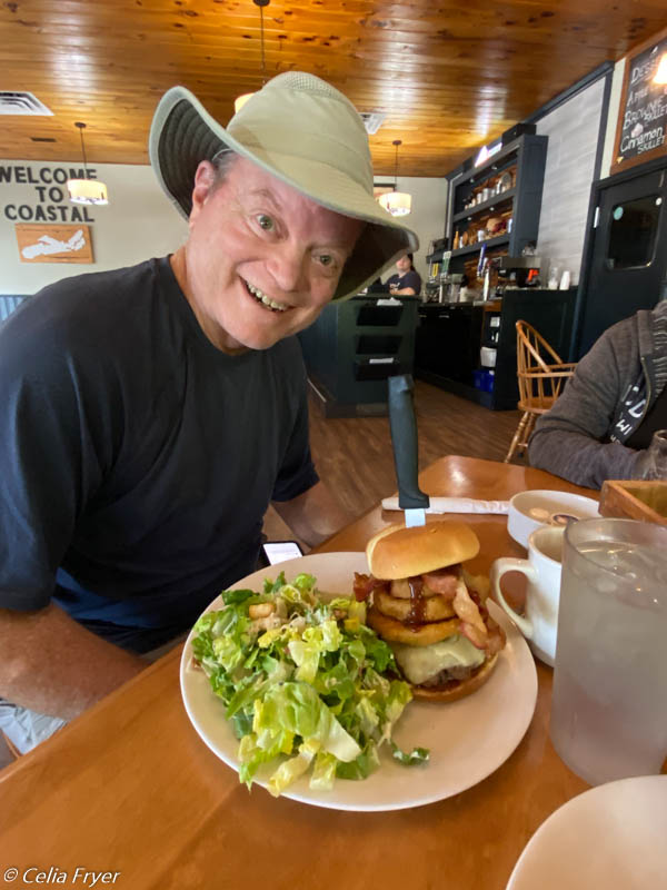
We worked up quite an appetite on the Cabot Trail so we stopped for dinner at the Coastal Restaurant and Pub in Ingonish. David ordered their signature burger called the Ringer Burger. It was more that a mouthful!
Even though we spent two days exploring the Cabot Trail by car and on foot, there were still more places that we wanted to see. We did not make it to Meat Cove, the northernmost town on the island, but we did get to see some picturesque areas and hike some lovely trails along the scenic Cabot Trail.
Next we explore one of the groups that immigrated to Cape Breton and we may even learn some Gaelic along the way.

wow, that is epic. I certainly need to take that drive some day.
LikeLiked by 1 person
Your pictures are beautiful! It looks like a place we’d love to see, but I am not sure our knees could withstand the hiking. Pat broke her right shoulder in late June but has rehabilitated well. She returns to work on Monday. Hope your vistas continue to be as engaging as these!
LikeLike