
As mentioned in our previous post, Dinosaur National Monument straddles the Utah/Colorado border. The Utah section is the site of the famed Dinosaur Quarry and the Colorado section is called Canyon due to its deep gorges carved by the Green River and the Yampa River. Be aware that there are no fossils in the Canyon part of the park.
At the Quarry and Canyon entrances are where you will find the only two Visitor Centers in the national monument. The Canyon Visitor Center is two miles east of Dinosaur, Colorado. It is 29 miles from the Quarry Visitor Center on Hwy. 40. To reach the Canyon area of the park, you must follow the Harpers Corner Road north for 31 miles. (In winter, there is no access to this area because they close the road.) This is a very scenic drive with several overlooks along the way that provide great views of the Canyon country.
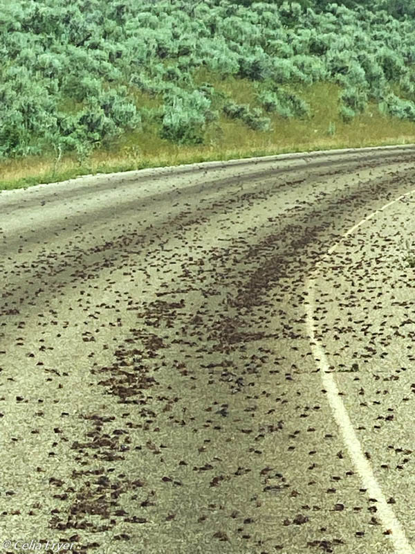
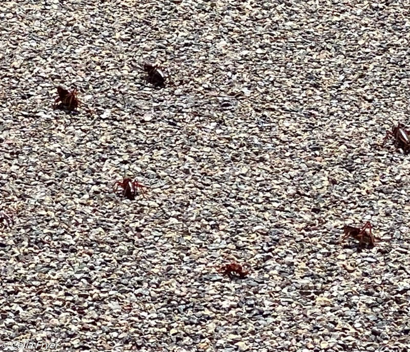
One thing that we did not expect to see were the swarms of “Mormon Crickets” that blanketed the road in places. These insects, actually not crickets but rather shielded-backed katydids, are found across the West and are devastating to crops. They earned their name when in 1868 there was an infestation of these insects in the Salt Lake Valley. According to the Mormons, their crops were spared when flocks of seagulls arrived and devoured the agricultural pests. The Mormon Crickets can travel up to a mile a day and can cover 50 miles in a season. At first we did not know what was all over the road and the vegetation beside the road. We thought that they were grasshoppers. We also noticed that were stretches of the road that were covered in thousands of crickets and distinct black tire tracks and in other places there were none. After talking to a ranger, he told us that they were not grasshoppers but rather they were Mormon Crickets. He also told us that they can cause hazardous driving conditions when the roads are wet. As the swarms of crickets are crushed under the tires, the surface of the road becomes very slick. These icy-like conditions have resulted in cars sliding off the highways. Since we had dry conditions that day, we did not have any trouble. In five years of being “on the road,” we have never encountered anything like that before. It was a novel experience for us.
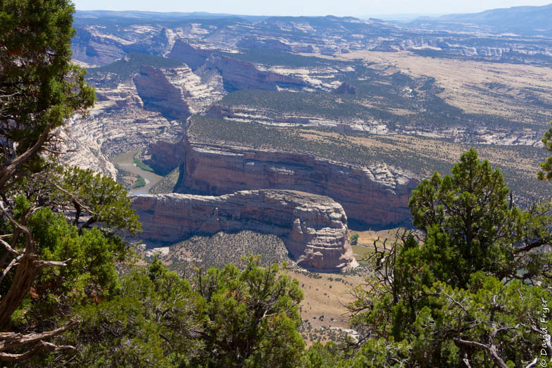
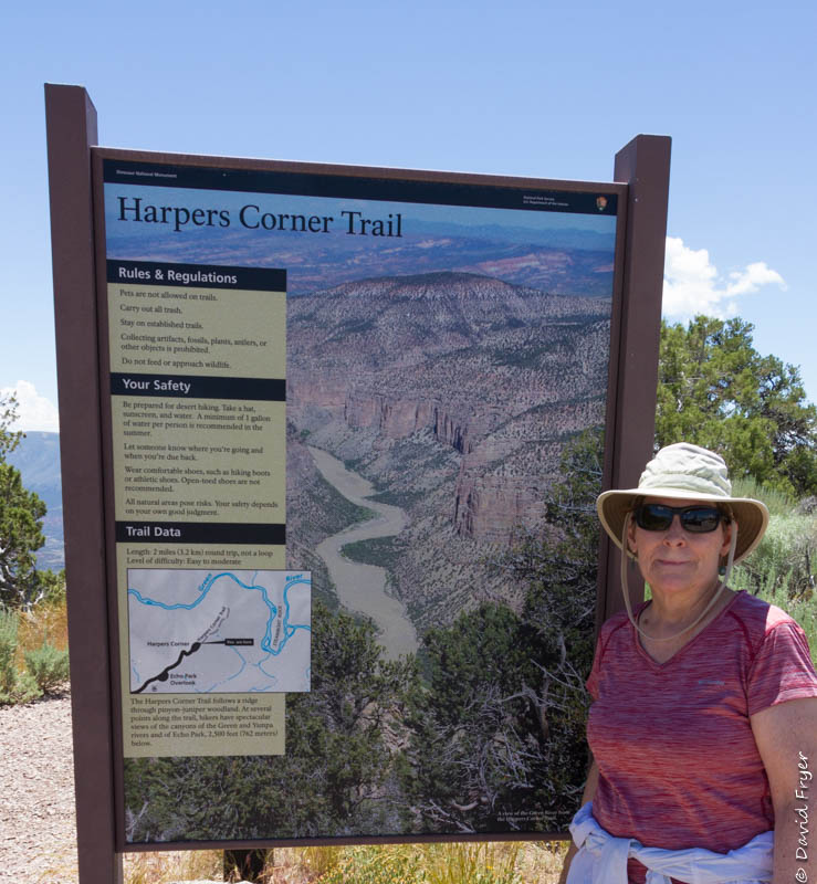
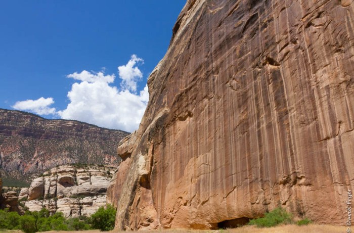
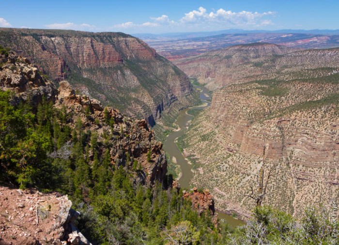
Harpers Corner is at the end of the road and it sits atop a sheer-walled canyon. From the parking lot, there is a 2 mile trail, the Harpers Corner Trail, that follows the ridgeline to an overlook. There is a trail guide and you will see numbered stops that provide additional information. When you reach the overlook, you will be about 2,500 feet above the canyon floor. This vantage point offers spectacular views of the canyons and the confluence of the Green River and the Yampa River.
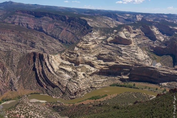
Another unique geological feature that you can observe from there is the Mitten Park Fault. When the rock layers were pushed up from below, they were also squeezed together forming a “fold” in the rock layers. When you look at it, you get a sense that the canyon walls are moving and undulating. It is definitely worth hiking out to the point to take in this expansive and unique Canyon country.
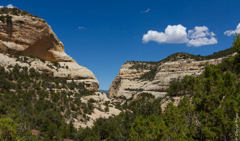
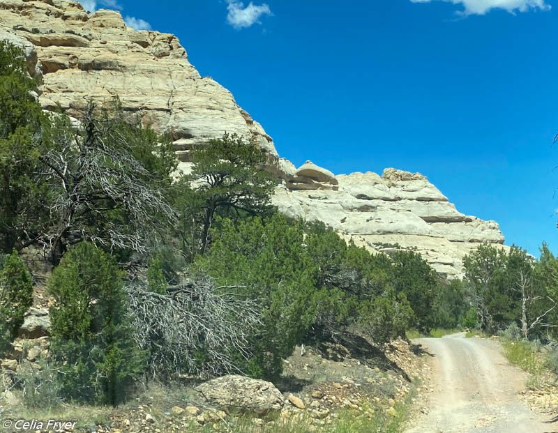
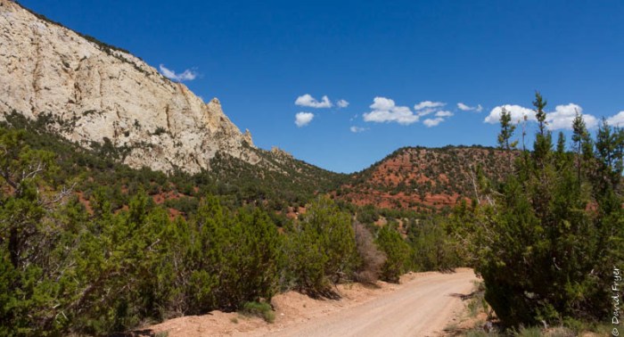
After eating our picnic lunch at the Echo Park overlook, we decided to go down into the canyon to see Echo Park. (Note that there are no fuel or food services anywhere in the national monument.) The road down into the canyon is unpaved and it requires a high clearance vehicle. When you first leave the paved road, there are a series of very steep and rocky switchbacks. We were told that if it rains and the road becomes wet, it is impassible. Luckily for us, it was a beautiful sunny day so we were able to make the 12 mile trek to Echo Park. In places, the road was rocky, curvy, and narrow so we had to be aware of oncoming vehicles. Even so, we would recommend it if you have the proper equipment because it gives you a different perspective as the road winds down past the towering multi-colored canyon walls through several unique canyon areas like Sand Canyon.
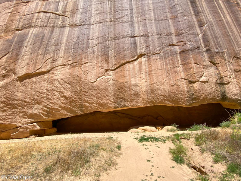
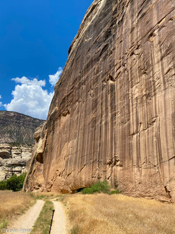
About one mile from Echo Park, we past by some petroglyphs and a cave called Whispering Cave. This is a fissure in a very tall sandstone rock that is cool on a hot day.
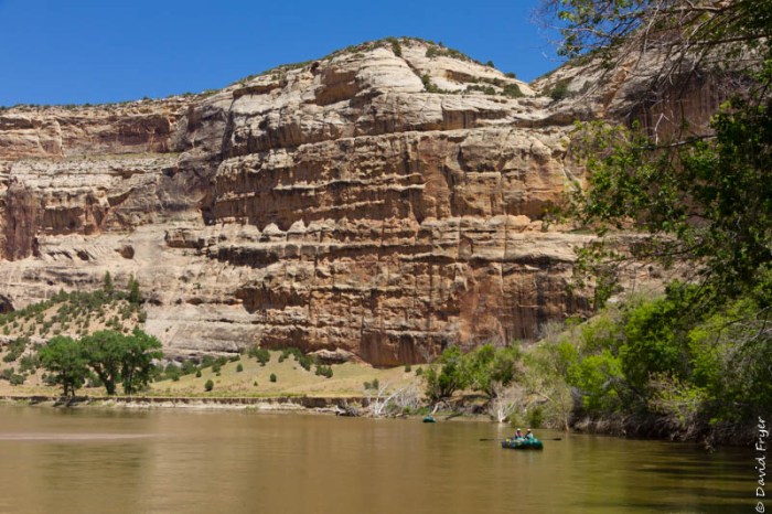
Echo Park is deep in the heart of Dinosaur National Monument and it is one of its most scenic and iconic locations. When we arrived, we walked down to the edge of the Green River to view the famous Steamboat Rock. This rock formation is a one mile long and 1,000 feet high ridge of sandstone. The Green River flows around its base. In 1875, when John Wesley Powell first saw this geographic formation, he named it “Echo Rock.” In 1941, a surveying team renamed it “Steamboat Rock.”
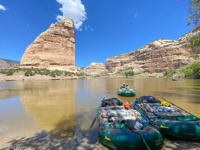
A group of park rangers and volunteers, who were on a five-day rafting trip down the Green River, stopped at Echo Park to take a break. We got to talking to them and learned that they were doing some maintenance work on the Green River. In addition to navigating the river and its rapids, they were pulling up and discarding invasive species of plants as they traveled. It was fascinating to get to talk to them for a few minutes.
At Echo Park, there is a campground, bathroom facilities, and a picnic area. We did see a number of tent campers there. It would be a great place to camp, to hike, and to spend some time but it is definitely not “big rig friendly”!
Echo Park is where the Green River and the Yampa River converge in Dinosaur National Monument. In the 1950s, the U. S. Bureau of Reclamation wanted to build a dam here as part of the Colorado River Storage Project. This project was designed to provide hydroelectric power, flood control, and water storage for the upper part of the Colorado River and its tributaries. Since the Green River and the Yampa River are tributaries of the Colorado River, they wanted to place a dam in this canyon and it would have flooded most of the Green River to a depth of 500 feet. Opponents of the project lobbied to keep the rivers unobstructed and free-flowing. Fortunately, Congress decided not to build any dams in any National Park or National Monument. Had they allowed the construction of the dam, Steamboat Rock would have been submerged and we would not be able to see this magnificent landmark. So glad they decided to protect many of the geological wonders of this region.
The day that we spent exploring was full of scenic beauty, exciting adventures, and unexpected nature. The Canyon country of Dinosaur National Monument is certainly one that we will remember for a long time.

Beautiful scenery! Thanks for sharing information about the Morman Crickets – never heard of them before, nor about what they can do to road conditions!
LikeLiked by 1 person
Really great photos of the rock formations! I’m grossed out by the crickets, though. I’ve run into large numbers of moths while skiing at night once, but never like this. I wonder where they come from?
LikeLiked by 1 person