

In our last post we were visiting the better known sites in the Magic Valley of Idaho, such as Shoshone Falls. While we were in the area, we also visited some lesser known but impressive spots in Southern Idaho.

One of those locations is the City of Rocks National Reserve near the borders of Utah and Nevada. We could not find much information about the area beforehand and almost decided not to go, but fortunately we did and had a great trip.
When driving along the back roads in this area, the first thing that strikes you about the Magic Valley is the amount of irrigation that is constantly taking place as far as you can see in every direction. Everyday the fields are watered with “linear move irrigation systems” traversing across the flat green landscape. While you do see fields of potatoes, typically we saw grasses for livestock and an abundance of corn.

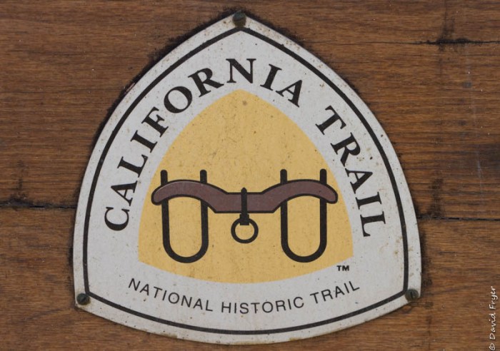
Shortly after passing through the small historic town of Almo, we arrived at the City of Rocks Visitor Center. We quickly discovered that this area is one of the most intact settings of the California Trail. I asked the park ranger where the California Trail splits with the Oregon Trail as I knew we were going to visit, a famous Oregon Trail site soon. It turns out that it is also in Idaho near American Falls in the eastern part of Southern Idaho. Over 200,000 travelers made their way to California via this route and it became especially popular after gold was discovered there.
The basin adjacent to the City of Rocks, is an area with plenty of grasslands and water. This became a popular resting spot for the emigrants before traveling the more difficult trail ahead, especially the Sierra Nevada mountains. Travelers often made the difficult decision to part with valued possessions at this location to reduce the weight they were carrying before climbing to higher elevations.
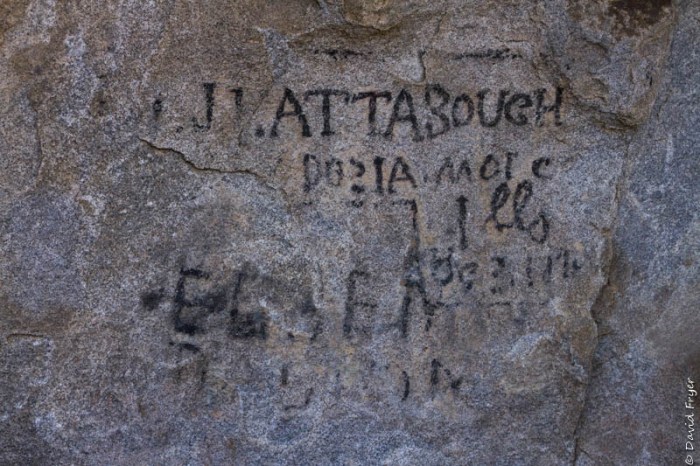
At Camp Rock, travelers would use axle grease to inscribe their names on the rock to commemorate that they had made it this far. One traveler scrawled on the rock his desire for a wife by the time he made it to California. This was a pioneer’s version of “match.com.”

Several other things surprised us about the City of Rocks: the number of people who were visiting that day and the beauty of the area. While very popular with rock climbers, there were plenty of others hiking and just exploring the unique land formations.


We hiked the Creekside Towers Trail along with the South Fork Trail to create a loop to return to our truck. The formations along the way have names such as the Morning Glory Spire, The Anteater, and Swiss Cheese. Several rock cliffs had groups of climbers making their way to the top.
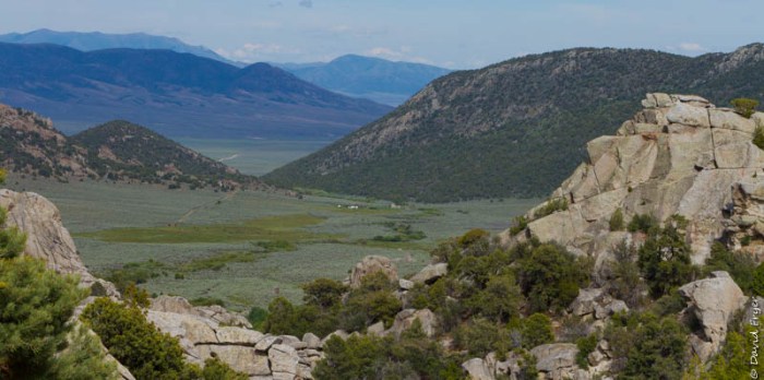
One of the first vistas along the trail is of the Circle Creek Basin where the emigrants camped and marveled at the geologic formations of the area. Taking care of the livestock was a vital part of the pioneer journey and this was a perfect place to rest for a while.
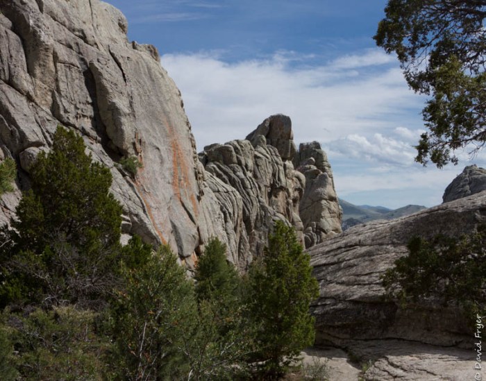
Next are the Creekside Towers themselves, which are tall spires, and a small stream that seems completely out of place among these rocks. I had to laugh at the ranger’s description that the trail went into the “inner city.”


For a visit that we almost canceled, Celia and I enjoyed our day in a preserve of history and geology in a remote part of Southern Idaho.

You discovered another beautiful and interesting place to explore.Thanks for sharing.
LikeLiked by 1 person