
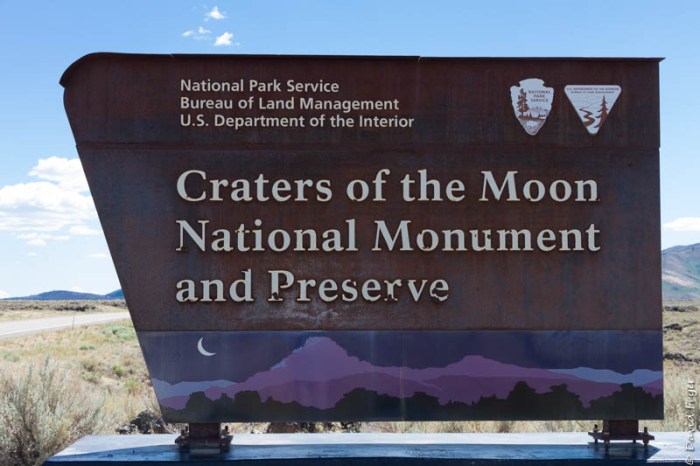
Craters of the Moon National Monument and Preserve is one of the places that David and I have wanted to visit in Idaho. As we made our way through Idaho toward Oregon, we decided to stay in Arco, ID for a couple of days so we could explore this unique part of the United States.
The first people to explore this area were the Shoshone. They created trails through the lava fields and used the lava caves as shelters while there. It is thought that their ancestors might have witnessed the last eruption more than 2,100 years ago.
It was not until the 1850s and 1860s that significant numbers of Europeans passed through this region. Many were traveling west along the Oregon Trail and chose to follow Goodale’s Cutoff. Tim Goodale, a trapper and trader, was hired to lead the first group of immigrants through this area to avoid confrontations with the Shoshone in the Snake River valley. The first group of travelers consisted of 795 men and 300 women and children. Their safe passage encouraged other Oregon Trail travelers to use this shortcut through the northern part of the monument. Other than the wagon trains and the Shoshone, there were not many people who frequented these lava fields for many years.


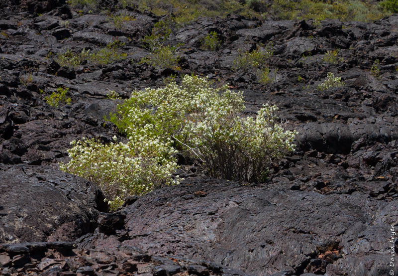

After seeing this lava filled landscape, we could understand why it was so difficult for explorers and travelers to pass through or even settle here. The black lava rock absorbs heat and the soil can reach 150° F in summer. There is little vegetation due to the scarcity of water. We did see wildflowers in bloom but these plants have adapted to this hot climate. For example, the dwarf buckwheat only grows to be about four inches tall but has root system that extends out three feet to capture more moisture. There is some shade to be found under some scattered pine, cedar, or juniper trees or in the lava caves. In winter, it can be very cold and the wind blows constantly. There is often several feet of snow and during that season the loop drive is closed due to snow drifts. For us, the wind was a blessing because it helped to moderate the temperatures on a hot and sunny day. In general, the landscape is barren and inhospitable.
In 1923, Howard Stearns, a geologist, dubbed this volcanic area “Craters of the Moon.” He thought that the terrain resembled what the surface of the moon would look like. (When the Apollo astronauts actually landed on the moon, they discovered that the moon’s surface was not like that found in Craters of the Moon at all.) Stearns petitioned the National Parks Service to set aside this geologically diverse region as a national monument to protect it. Robert Limbert also published several articles touting the area’s “peculiar features.” Calvin Coolidge did approve the establishment of the National Monument in 1924. With the addition of more acreage in 2002, Craters of the Moon National Monument and Preserve now covers 750,000 acres.

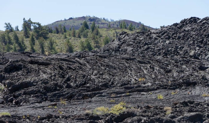
The National Monument includes three lava fields that lie along the 53-mile long series of fissures in the earth’s crust called the Great Rift of Idaho. Within the lava fields there are 25 volcanic cones and 60 distinct lava flows. Numerous open rift cracks or fissures are visible in the lava flows and one of them is 800 ft. deep, the deepest one on Earth. In the National Monument’s boundaries there are a wide assortment of basaltic lava features from lava tubes to cinder cones. It is unusual to find so many different features in one place.

We began our visit at the Visitor Center where we secured a permit to enter the lava caves and also got information about the park. From the seven mile scenic drive there are a series of trails, some long and others very short, that take you to some of the volcanic features of note. Starting at the Visitor Center, there are 6 recommended stops along the loop road.

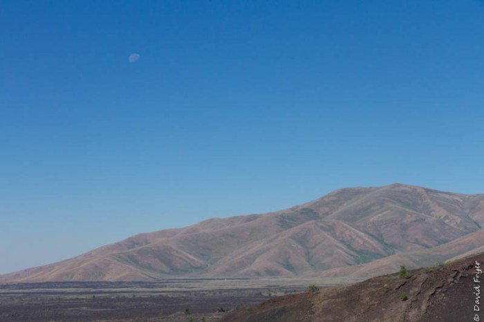
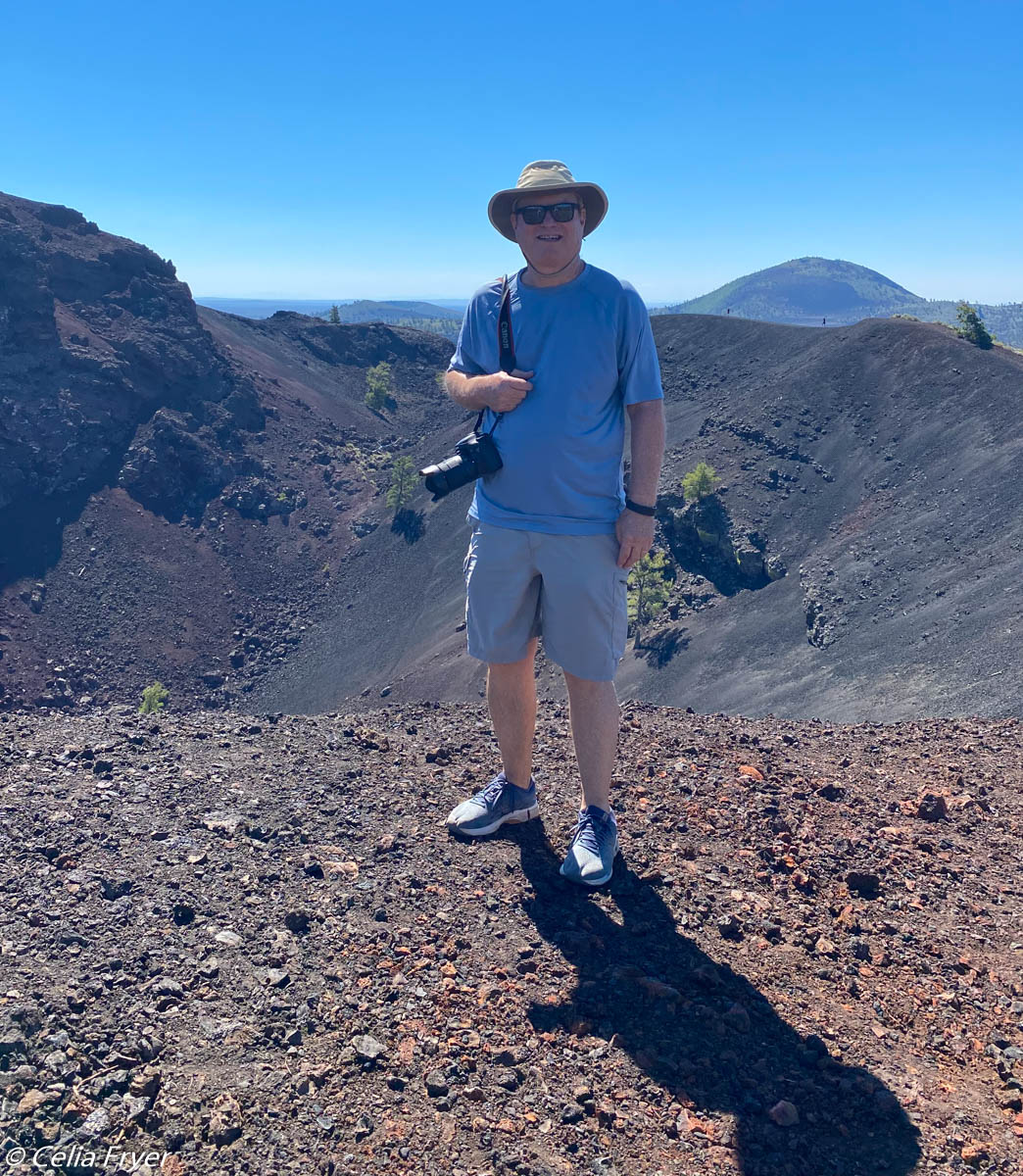
Our first stop was at Inferno Cone which is a tall cinder cone along the Great Rift. If you hike up the short but steep trail to the top of it, you can look out over the lava fields and can also see Big Cinder Butte, one of the largest in the world. In the distance are the Pioneer Mountains. It is a great viewpoint because it offers a 360° view of the Monument.
Once we climbed down off the mountain, we went in search of spatter cones and a large crater. The spatter cones look like mini volcanoes. They were formed when volcanic pressure spewed up blobs of lava through a vent in the surface.

We hiked a bit farther up the trail and looked down into a large cinder cone crater. While this area appears to be dormant and has trees and some vegetation growing in it, it is still active and geologist continue to monitor it. They say that they expect eruptions here in the next 100 years.

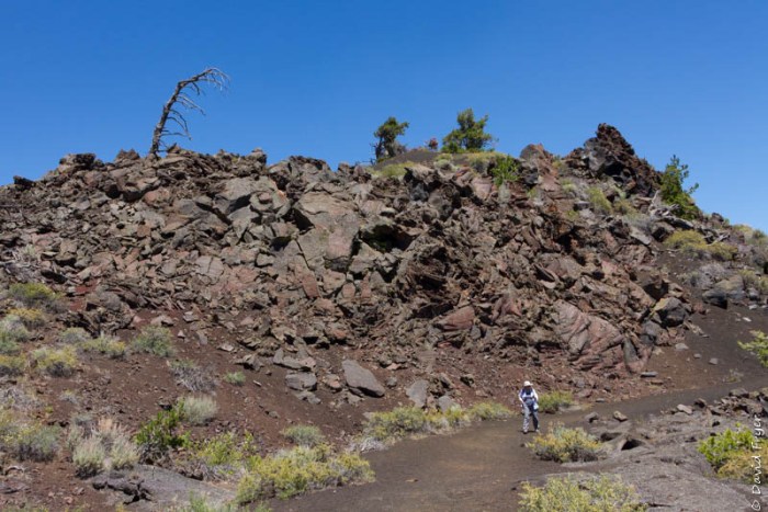
Three trails begin from the parking area at our second-to-last stop. The Wilderness Trail goes 6 miles out into the back country of the Monument. The second trail leads to the Tree Molds area. These formed when lava flowed through a stand of trees and burned them up leaving behind molds of the tree trunks. The third trail is the Broken Top Loop Trail which circumnavigates a cinder cone. We decided to hike Broken Top because we would encounter a variety of lava features along the way.

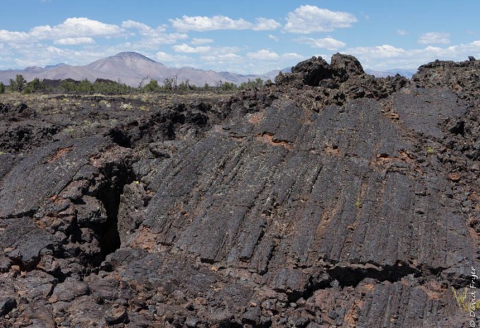
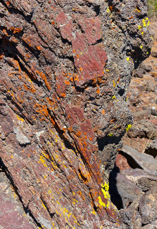
As we climbed up the cinder cone, we had great views of a massive lava flow called Blue Dragon. Here the lava is iridescent with a blue glass color and a jagged surface. Early explorers thought that it looked like dragon skin, thus the name. Farther up the trail, there is an overlook with views of Big Southern Butte to the east.
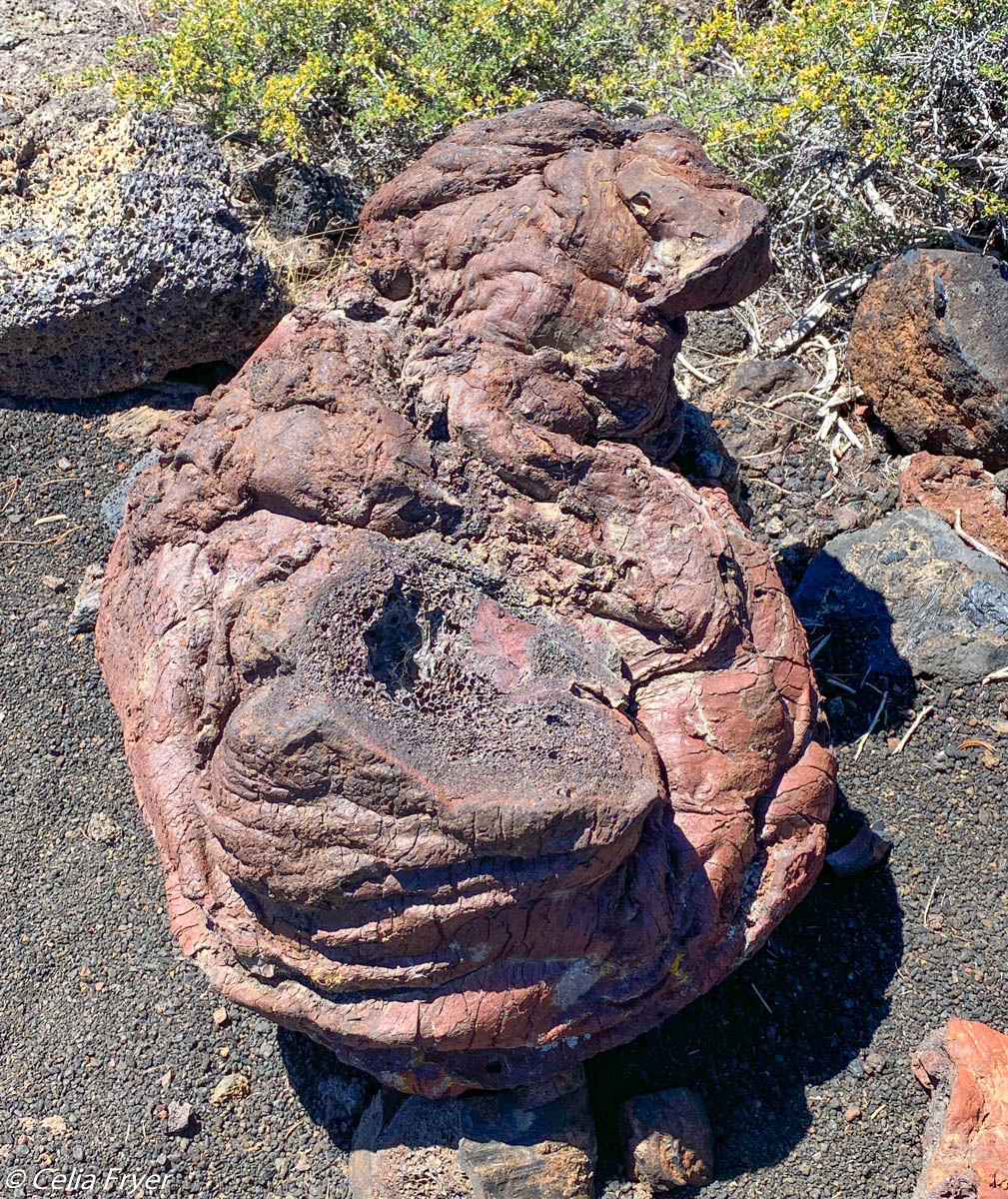
As we came around to the other side of the cinder cone, we saw Lava Bombs which are large globs of molten rock that were hurled into the air from the fissures. Some of these bombs weigh 100 pounds. Many have cracks on the outer crust so they are called “Bread Crust” bombs. Others twisted into interesting shapes as they spiraled through the air. We also saw where the hot lava came into contact with the colder surface air resulting in rounded and buckled surfaces.

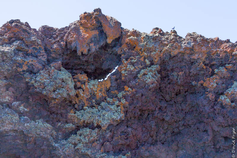
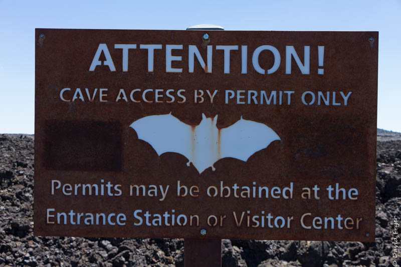
We passed by several lava tubes but did not enter them because they were closed to protect the bats who live in them. These lava tubes were quite small and we had no desire to disturb the bats so we moved on. We liked this trail because we got to see many unique features that we had not observed elsewhere in the park.

Our final stop was the Lava Cave Area. There are four caves there: Dewdrop, Boy Scout, Beauty, and Indian Tunnel. We walked by Dewdrop, which was not very big or deep, on our way to Indian Tunnel, the largest of the four caves. Indian Tunnel is a tube that is 30 ft. high, 50 ft. wide, and 800 ft. long.

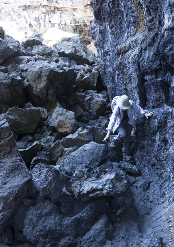
We accessed the cave via a steep staircase that delivered us to the cave’s floor. It was rocky and uneven so we were glad that we had on sturdy shoes. It was light enough for us to see in the cave so you don’t have to have a flashlight but you might want to bring one anyway. We walked the length of the cave. At the far end of the lava tube, we had to scramble up a series of large rock piles. It was a challenge to find the best route over the boulders. We exited through a small opening at the surface. It was like a gopher hole in the lava surface. If you don’t want to rock climb, you can always exit using the staircase at the entrance. It was amazing to think that these lava tubes were created when the sides and the surface of the lava flow hardened so many years ago and they are still here. It was a unique experience to be in such a lava tube.


Craters of the Moon has a 42 site campground. Note that water is available in warmer months, but there is no electricity at the sites and there is no dump station there either. The campground is designed for smaller campers. Larger rigs would fit in just a few of the sites. Had we stayed at the park’s campground, however, we could have also enjoyed seeing the stars and other celestial bodies at night since it is also a designated international dark sky park.
When asking fellow travelers whether to visit Craters of the Moon Monument and Preserve, we got very mixed responses. Some suggested we pass it by and others felt that is a “can’t miss!” After our day trip to this unique area, we were glad that we made the detour to explore this other worldly place.

Interestingly, the town of Arco, Idaho promotes itself as the first town in the world to be powered solely by nuclear power. It was only powered for one hour in 1955 but history is history.

Speaking of history, the other unique feature in town is the very large “graduation hill.” The last two digits of each year’s graduating class is inscribed on a mountainside visible from town. It is quite a sight in the setting sun.

A couple of years ago we spent about a month in Idaho and the lava fields were so interesting. We’re in Kansas now heading west. Tonight, Dodge City! Larry loves the cowboys and westerns! Travel safely!
LikeLiked by 1 person
Have fun on your trip. Enjoy your family time too. The Craters of the Moon are interesting but so difficult to really capture in photographs.
LikeLike
We thoroughly enjoyed Craters of the Moon. Somehow we managed to squeeze our rig into one of the dry camping sites in the park You don’t get a campsite like that every day!
LikeLiked by 1 person